Eaton Saddle to Markham Saddle to Mount Lowe Summit - Member Hike
| Hike Name: | Eaton Saddle to Markham Saddle to Mount Lowe Summit |
|---|---|
| Country: | United States |
| State: | California |
| Nearby Town: | La Canada-Flintridge |
| Rating: |  |
| Directions: | From 210 FWY take Angeles Crest HWY 14 miles North of La-Canada. Turn Right on Mt. Wilson HWY 2.5 Miles to Eaton Saddle. There are two large parking areas on either side of the HWY. -A National forest Adventure Pass is required on your parked vehicle- |
| Total Hike Distance: | 3.00 miles |
| Hike Difficulty: | Easy |
| Permit Required: | No |
| Hike Type: | In & Out, Backtrack Hike |
| Hike Starts/Ends: | Eaton Saddle |
| Trails Used: | Mount Lowe Fire Road, Mount Lowe East Trail, Mount Lowe West Trail |
| Backcountry Campsites: | No |
| Backcountry Water Sources: | None |
| Management: | U.S. Forest Service |
| Contact Information: | Angeles National Forest |
| Best Season: | Winter, Spring, Summer, Fall |
| Users: | Hikers |
| Road Conditions: | Primary Paved Roads |
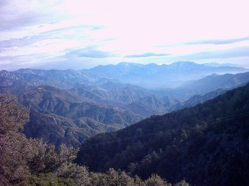
| Hike Summary: | Copy/paste #30 In John W. RObinsons "Trails of The Angeles" 500' Elevation Gain This Hike takes you up the backside of Mount Lowe. It is by far the easiest way up. Although you miss the historical markers that are placed on the Railway Loop route up Mt. Lowe, The trip from Eaton saddle is a rewarding one. There are of course sight tubes, and a historical plaque at the summit. This hike would be a good introduction to the rich history of Mount Lowe, and perhaps inspire you to visit the other related sites(Echo Mountain, Mount Lowe Tavern, Inspiration Point Pavillion). You begin at Eaton Saddle and follow the fire road through the Mueller tunnel (1947). The tunnel by-passes the old trail from Mount Lowe. This trail was carved out of the rock and went around the side of San Gabriel Peak. The drop of was 100 verticle feet. You can still see part of the trail and the handrails just outside of the tunnel. Continue down the fire road to Markham Saddle. The trail to Mount lowe is on your left. There is a metal trailhead sign. Directly across to your right is a trail leading up to San Gabriel Peak. This is a good side-trip option. Continuing down the fire road would take you to the Mount Lowe Campground(Historical Mt. Lowe Tavern site). Follow the signed Mt. Lowe trail as it gently ascends through tree cover. After a short distance the cover gives way and the trail curves left. Just beyond an unmarked trail appears at your right(Mt. Lowe East Trail). Follow this trail up and around Mt. Lowes rocky summit. Near the top you pass the intersection of the Mount Lowe West Trail. Continue ahead about 100 yards to the summit. Return the way you came. |


There are no comments yet.