Cloud's Rest @ Yosemite NP - Member Hike
| Hike Name: | Cloud's Rest @ Yosemite NP |
|---|---|
| Country: | United States |
| State: | California |
| Nearby Town: | Fresno, CA |
| Rating: |  |
| Directions: | Fly to Fresno then travel approximately 2.5 hours Northeast then take Tioga Rd. to Tenaya Lake, at 8,200 ft., trail head for the hike to Cloud’s Rest. |
| Total Hike Distance: | 14.00 miles |
| Hike Difficulty: | Very Difficult |
| Permit Required: | No |
| Hike Type: | In & Out, Backtrack Hike |
| Hike Starts/Ends: | Tenya Lake Parking area |
| Trails Used: | Cloud's Rest Trail |
| Backcountry Campsites: | Yes |
| Backcountry Water Sources: | Streams |
| Management: | National Park Service |
| Contact Information: | by mail Superintendent P.O. Box 577 Yosemite National Park, CA 95389 By Phone Visitor information & Headquarters 209-372-0200 |
| Best Season: | Spring, Summer |
| Users: | Hikers |
| Road Conditions: | Primary Paved Roads, Secondary Paved Roads |
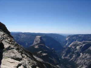
| Hike Summary: | Cloud’s Rest is a peak, 9,926 ft. high, on the North side of the valley overlooking Tenaya Canyon with Half Dome and Yosemite Valley in the distance and a clear, virtually unlimited 360 degree view of the surrounding countryside. The hike was a 14 mile round trip with a very steep, half mile climb of about 800 ft. at around the 2 mile mark, VERY rough on the upgoing muscles. The trail then continues down about another 500 ft. which, of course, must be regained enroute to the summit. But the rest of the hike consisted of mostly fairly easy ups and some downs until you reach around the 6 mile mark, then climbs the final 500 ft. of elevation or so in the last quarter mile. The side trail to the summit climbs at about a 40 degree angle and is not for those with a fear of heights, since it narrows to 2 to 3 feet in width with sharp drop offs on either side. About 200 ft. from the summit the defined trail essentially disappears and you rock hop your way over rock slabs and boulders on to the top. But the view is worth the effort, possibly the best in the park. One hiker we met described it well as “terrifyingly beautiful”. From the summit there is a drop on two sides of around 2,000 ft. to Tenaya and Sunrise Creeks on the right and left respectively and in front a drop straight down 1,500 ft. to a plateau before the land rises again to the 8,842 ft. summit of Half Dome, 6 miles away. Ate lunch at the summit before returning over the same trail. |


There are no comments yet.