BuckHorn to Mount Waterman - Member Hike
| Hike Name: | BuckHorn to Mount Waterman |
|---|---|
| Country: | United States |
| State: | California |
| Nearby Town: | La Canada-Flintridge |
| Rating: |  |
| Directions: | Off angeles Crest Hwy adjacent to Buckhorn campground. 34 miles north of La Canada. Use the parking Area on the left, just outside of the Buckhorn campground. Cross Angeles Crest directly across from parking area. Trailhead is loacated behind large wooden sign (for ski area). -NATIONAL FOREST ADVENTURE PASS REQUIRED- |
| Total Hike Distance: | 5.00 miles |
| Hike Difficulty: | Easy to Moderate |
| Permit Required: | No |
| Hike Type: | Roundtrip, Loop Hike |
| Hike Starts/Ends: | Parking area just outside Buckhorn Campground |
| Trails Used: | Mount Waterman Loop Trail |
| Backcountry Campsites: | No |
| Backcountry Water Sources: | Snow |
| Management: | U.S. Forest Service |
| Contact Information: | Angeles National Forest 701 N. Santa Anita Avenue Arcadia, CA 91006 626-574-1613 www.r5.fs.fed.us/angeles |
| Best Season: | Winter, Spring, Summer, Fall |
| Users: | Hikers, Dogs |
| Road Conditions: | Primary Paved Roads |
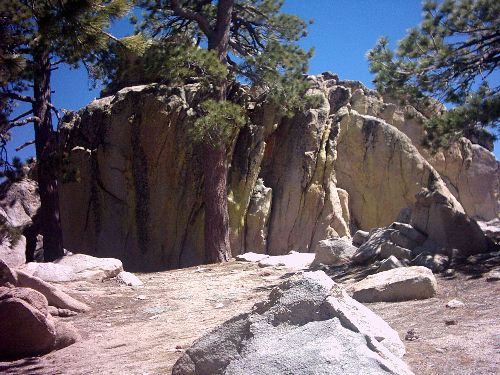
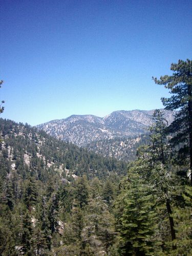
| Hike Summary: | In process of adding. Writing in word because server ALWAYS drops me. 1300' Elevation gain on Excellent trail. This hike is a favorite of mine. It can be completed easily by just about anyone, or done at a faster pace for a more moderate hike. The even grade on well maintained trail makes it very easy to follow in most places. There are a couple of places to pick up the loop trail. This can be confusing because of a couple of fire roads crossing the trail. I pick up the trail directly across from the West corner of the parking area just outside Buckhorn Campground. There is a large wooden sign for the ski slopes. Just behind it is the trail marker. From here the trail runs parrallel to the hwy passing the fire road and another trail marker. Once past the fire roads the trail contours around passing a picnic table, and crossing a small stream. Last time I was there a new log bridge was placed over the stream. From Here the trail gently wraps around the northern slope. You walk through an open forest of pines and rocks. There is evidence of charring on nearly every tree you pass. The trail contours to the mountain’s ridgeline, and the edge of the San Gabriel Wilderness. The trail runs just below the ridge, and the best views are obtained by going off trail and standing on one of the many rock out-croppings along the way. Once on the ridge many areas are broad and flat, with large rock formations jutting out here and there. At 1.25 miles you reach a trail junction. Straight leads down to Twin Peaks saddle. Go right here and switchback up to the summit plateau. Here the trail becomes less defined, as you reach the summit sign (not the actual summit). There are plenty of opportunities to explore around this flat region. Walk around the southern edge to get the best views of devil’s canyon, and Twin peaks. From the summit sign hike south west for the “actual” summit and the best views. From here the trail meets with the fire road and down the mountain. You can continue down the fire road, and ski area making it a loop hike, or return the way you came. Additional info here. http://www.localhikes.com/HikeData.asp?DispType=0&ActiveHike=2&GetHikesStateID=1&ID=5861 |


There are no comments yet.