Bailey Canyon Park to Jones Peak - Member Hike
| Hike Name: | Bailey Canyon Park to Jones Peak |
|---|---|
| Country: | United States |
| State: | California |
| Nearby Town: | Sierra Madre |
| Rating: |  |
| Directions: | From the 210 Foothill Freeway Arcadia, exit Baldwin Avenue and go north (Straight). Baldwin Avenue ends at Carter st. Turn Left. Take Carter about 1/3mi. The Parking lot will be on your right. If you reach a dead-end, you just passed it. The park closes at dusk, so plan accordingly. |
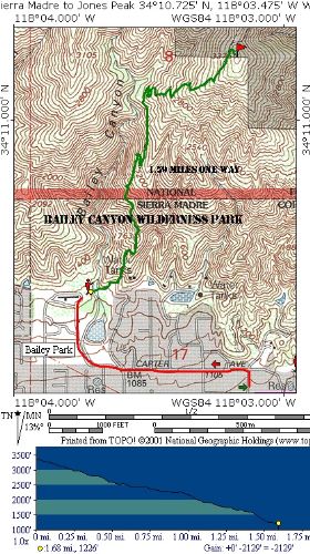
| Total Hike Distance: | 4.00 miles |
| Hike Difficulty: | Easy to Moderate |
| Permit Required: | No |
| Hike Type: | In & Out, Backtrack Hike |
| Hike Starts/Ends: | Bailey Canyon Wilderness Park |
| Trails Used: | Bailey Canyon Trail |
| Backcountry Campsites: | No |
| Backcountry Water Sources: | Streams |
| Management: | City Park Service |
| Contact Information: | City of Sierra Madre City Hall 232 W. Sierra Madre Blvd. Sierra Madre, CA 91024 T:626.355.7135 http://www.cityofsierramadre.com/index.php?mod=parks http://www.cityofsierramadre.com/index.php?pageNum_rsRelPages=0&totalRows_rsRelPages=6&mod=bailey_canyon |
| Best Season: | Winter, Spring, Fall |
| Users: | Hikers, Dogs |
| Road Conditions: | Primary Paved Roads |
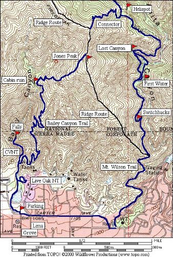
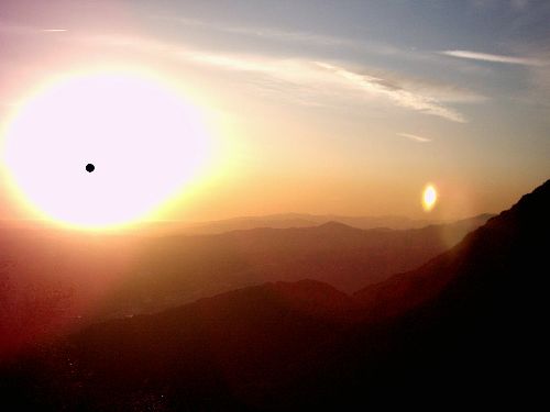
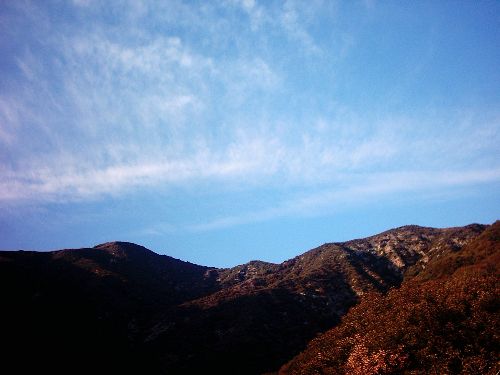
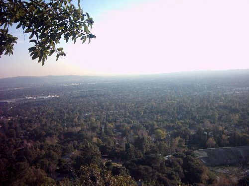
| Hike Summary: | #34 in John W. Robinsons “Trails of the Angeles” 4.2 Miles In and Back Elevation Gain/Loss=2264’ This is another fine trail hike operated by the City of Sierra Madre’s park system. As with the Mount Wilson trail sections, Bailey Canyon’s trails are well maintained with minimal trash/graffiti despite the sometimes heavy usage they receive. The highlights of this hike are the views of Los Angeles, Catalina Island, The San Gabriel Valley, Santa Monica Mountains, and the Coast line. The orientation of the trail assures a good view from nearly every point on the trail. The down side is the open exposure to the sun, and the noise from the 210 freeway. Despite the latter it is well worth it. You begin your hike in the Bailey canyon park. Walk to the NW corner of the park and exit through a turnstile. Follow the paved road past a drainage dam to it’s end. On your right will be a footbridge leading to the nature center hike. This is a pleasant enough side-trek if you choose to take it. Our trip continues straight. Walk a few dozen additional yards and another junction appears. Continue to the right or take a short ¼ mile trail to the waterfall. Once past the junction, the trail switchbacks steadily up the canyon. About ¾ mile up there is a bench that faces the view of the ocean. The trail continues up and at about the 2 mile mark you enter a live-oak forest. The ruins of a cabin are present. It’s best to rest and/or snack here either before or after the summit. This is some of the only shade you will get. Continue up trail a short distance to a saddle just north of the peak. The last stretch to the summit is a semi-scramble. It’s short but steep. The path is pretty easy due to the volume of hikers who scramble up. Enjoy the view from the summit and return the way you came. I have added a topo that shows some suggested alternatives you can take with this hike. The best of which takes you beyond the summit saddle to connect with the Mt. Wilson trail (see my review of this trail). |


There are no comments yet.