Waters Creek Falls - Member Hike
| Hike Name: | Waters Creek Falls |
|---|---|
| Country: | United States |
| State: | Georgia |
| Nearby Town: | Dahlonega |
| Rating: |  |
| Directions: | On Us 19 North of Dahlonega turn left at the "Chattahoochee Wildlife Management Center" Sign. (Before Turners Corner). Follow the road continuing after it turns to gravel. There will be a parking area on the right. About 2.8 when the road turns to F.S. 34 |
| Total Hike Distance: | 0.10 miles |
| Hike Difficulty: | Easy |
| Permit Required: | No |
| Hike Type: | In & Out, Backtrack Hike |
| Hike Starts/Ends: | Parking Lot |
| Trails Used: | Many foot paths down to the falls. |
| Backcountry Campsites: | No |
| Backcountry Water Sources: | Streams |
| Management: | State Park Service |
| Contact Information: | Unknown |
| Best Season: | |
| Users: | |
| Road Conditions: | Secondary Paved Roads, Maintained Gravel or Dirt Roads |
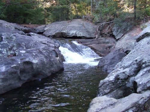
| Hike Summary: | Beautiful waterfalls form from Blood Mountain Stream and Waters Creek. The falls are visible from the road however a better view can be see taking one of the several foot path trails. This is not a maintained area however the parking lot does have an outhouse. |

Recommended


Trip Reports
There are no Trip Reports yet.
One reply on “Waters Creek Falls - Member Hike”
These falls are known as “Dicks Creek” to most locals. However, be prepared for it to be overcrowded on the weekend and littered with trash.