Uwharrie National Forest: Dutchman's Creek/Uwharrie National Recreational Trail Loop - Member Hike
| Hike Name: | Uwharrie National Forest: Dutchman's Creek/Uwharrie National Recreational Trail Loop |
|---|---|
| Country: | United States |
| State: | North Carolina |
| Nearby Town: | Troy, NC |
| Rating: |  |
| Directions: | From US-220, take Biscoe exit and head West on NC 24/27. Pass the recycling center on north side of highway and parking area is about a mile and a half after that. |
| Total Hike Distance: | 18.00 miles |
| Hike Difficulty: | Easy to Moderate |
| Permit Required: | No |
| Hike Type: | Roundtrip, Loop Hike |
| Hike Starts/Ends: | Uwharrie Scenic Trail, southern trailhead |
| Trails Used: | Dutchman's Creek Trail, Uwharrie Scenic Trail |
| Backcountry Campsites: | Yes |
| Backcountry Water Sources: | None, Streams |
| Management: | U.S. Forest Service |
| Contact Information: | U.S. Forest Service, P.O. Box 2750, Asheville, NC 28802 828-257-4200 http://www.cs.unca.edu/nfsnc/recreation/uwharrie/index.htm |
| Best Season: | Winter, Fall |
| Users: | Hikers, Dogs |
| Road Conditions: | Primary Paved Roads |
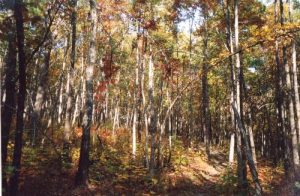
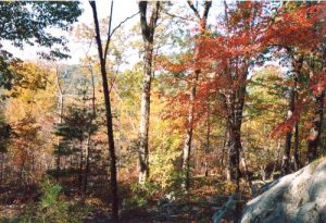
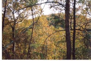
| Hike Summary: | This hike was a pleasant surprise as I was looking for something closer to Myrtle Beach without having to drive 5+ hours to upstate SC or NC and could do in a weekend. The geology of the Uwharrie 'range' is interesting in that they were once 20K+ ft volcanoes! As a result, I'd say over 50% of the trail has a rocky footing - so bring comfy shoes/boots. The hike is a figure 8 loop that begins with the Dutchman's Creek Trail (yellow blazes) and intersects the Uwharrie National Recreational Trail (white blazes) once, then again about 10 miles in. From there you head south on the Uwharrie Trail back to the trailhead. I arrived at the trailhead about 11:30 on a Saturday morning and found a half full parking lot. Come to find out that most were mountain bikers using the logging roads that criss cross the national forest land. The hiking is a relatively easy walk in the woods with gentle relief. This changes when you get to the mountains of the park. Yes, these mountains are only a few hundred feet high, but they are called mountains on the map. There are probably 3-4 climbs along the whole loop that are strenuous. Each are about 250 ft climbs straight up the side of the mountains. For one of them, the path is cut right into the marble/quartz/schist and that is the trail! Switchbacks? What are those? These climbs, albeit short, were just as steep as anything on Table Rock, SC. For the beginning of November, the leaves were changing colors and the temps during the day were in the upper 70's and in the 50's at night so shorts and a t-shirt were all I needed. Unfortunately the thick foliage and young age of the forest (this is timber country) kept me from having any camera-worthy vistas of the neighboring ridges full of color. I could catch very promising glimpses here and there through the cover, but no unobstructed views. I would not like to try and hike this trail during the summer for the heat and bugs. Water was another issue - there isn't much of it. Dutchman's creek is the only reliable source and that, combined with being half-way, was where I made camp about 4:30 Sat. night - right along the creek. Other drainages are crossed, but if there is water, it is not moving and a bit shady as far as reliable. I broke camp about 8am Sunday and was back at the car by 1pm. I saw one group of Scouts backpacking and 1 other pair of hikers and that was it. Around dusk there were a few gunshots (hunting season), but Sadie and I were both prepared and wearing orange/bright colors. Although she woke up a few times and barked out into the night, I didn't see much wildlife at all the whole time save birds and their singing. I would recommend this hike for experienced and beginners alike and would do it again. I would choose the winter for cooler weather and views unobstructed by leaves. |
Recommended
Trip Reports
There are no Trip Reports yet.


 Trail Map For This Area
3 replies on “Uwharrie National Forest: Dutchman's Creek/Uwharrie National Recreational Trail Loop - Member Hike”
Great write up. I hiked this with my fiance in late june/early july 2011, only did the first half of the loop as her ankles were starting to weaken. doing the whole thing (hopefully) with my 7 year old son this coming weekend, great starter trail!
Thanks for this post. It was very helpful. You answered all of my concerns about hiking in Nov. Thanks.
Looks like a great trail, however, I just have one question. Is there any primitive camping allowed other than at the half way point? I’m looking at doing this hike, but not sure if I will have enough time to get to the half-way point on the first evening. Thanks!