Turkey Pen Gap, South Mills River – Pisgah National Forest. - Member Hike
| Hike Name: | Turkey Pen Gap, South Mills River – Pisgah National Forest. |
|---|---|
| Country: | United States |
| State: | North Carolina |
| Nearby Town: | Brevard |
| Rating: |  |
| Directions: | Hwy 276, 64 and 280 from Brevard towards Hendersonville. Continue through intersection where 276 goes left, 64 goes right and 280 goes straight. Go straight on 280 for about 4 miles to a left on Turkey Pen road, FS Rd 297. This road is a dirt & gravel road, very rough and easily missed, so be watchful Go to the end of the road and the parking area for various trail heads. Heading into the parking area, the Turkey Pen Gap trail begins on the left side. |
| Total Hike Distance: | 6.00 miles |
| Hike Difficulty: | Moderate to Difficult |
| Permit Required: | No |
| Hike Type: | Roundtrip, Loop Hike |
| Hike Starts/Ends: | Turkey Pen Gap Parking area |
| Trails Used: | Turkey Pen Gap, Wagon Road Gap, and South Mills River trails |
| Backcountry Campsites: | Yes |
| Backcountry Water Sources: | Streams, Rivers |
| Management: | U.S. Forest Service |
| Contact Information: | Pisgah Ranger District 1001 Pisgah Highway Pisgah Forest, NC 28768 (828) 877-3265 |
| Best Season: | Spring, Summer, Fall |
| Users: | Hikers |
| Road Conditions: | Primary Paved Roads, Maintained Gravel or Dirt Roads, High Clearance Vehicle Recommended |
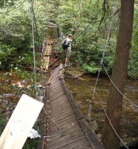
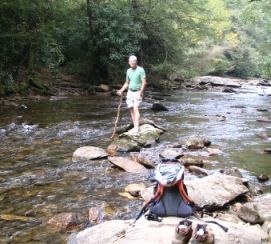
| Hike Summary: | This is a loop hike, initially climbing steeply to the top of Sharpy Mt. and following the top of a ridge affording winter views of the South Mills River valley. At roughly 2 miles find a junction with the Wagon Road Gap Trail on the right. Take this trail about a half mile down and to a junction with the South Mills River Trail. Take a right on this trail to a crossing of the river. There used to be a suspension bridge over the river here but it has been washed away and not repaired. You must cross the river on foot, probably wading across since rock hopping means several really long hops. Once on the other side, continue down stream paralleling the river for 2.5 miles, cross the river, on a bridge this time, and arrive at a t-junction, the left continues the South Mills River trail and the right goes back to the trailhead at the parking lot. |
Recommended
Trip Reports
There are no Trip Reports yet.


 Trail Map For This Area
3 replies on “Turkey Pen Gap, South Mills River – Pisgah National Forest. - Member Hike”
Great trail every time I have gone, all four seasons. I would like to know how deep the water is at the washed out suspension bridge, and or where is the best place to cross. Upstream from the bridge or downstream? Going with a bunch of friends in early March and the recon would be nice.
That would have been a very fun bridge crossing – the other side had no cables that were anchored on anything. We looked at it after we had crossed the river. Much worse from that side. Only option was to get your feet wet. But worse things could have happened.
That looks like a really fun bridge crossing! 😉