Tribble Mill Park Trail- New Ga Trail - Member Hike
| Hike Name: | Tribble Mill Park Trail- New Ga Trail |
|---|---|
| Country: | United States |
| State: | Georgia |
| Nearby Town: | Gwinnett County, GA |
| Rating: |  |
| Directions: | After entering the park, go straight past the kiosk and look for the first parking lot on the left, overlooking the lake. Return to the trail at the entrance to the parking lot and turn right. |
| Total Hike Distance: | 3.00 miles |
| Hike Difficulty: | Easy |
| Permit Required: | No |
| Hike Type: | Roundtrip, Loop Hike |
| Hike Starts/Ends: | trail at the entrance to the parking lot |
| Trails Used: | Tribble Mill Park Trail- Estimated 20 miles of undeveloped trails in the park. |
| Backcountry Campsites: | No |
| Backcountry Water Sources: | Streams, Lakes |
| Management: | City Park Service |
| Contact Information: | http://georgiatrails.com/trails/tribblemill.html |
| Best Season: | Winter, Spring, Summer, Fall |
| Users: | Hikers, Bikers, Dogs, Horses |
| Road Conditions: | Primary Paved Roads, Secondary Paved Roads |
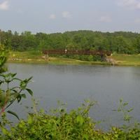
| Hike Summary: | A recent addition to the Gwinnett County Parks system, 800-acre Tribble Mill was privately held until the late 1990's when the county purchased the land. Tribble Mill operated from the 1830's until the 1950's on a river in the park. The county inundated the site when it built Ozora Lake and Chandler Lake, both fully contained within the park. The paved loop trail that circumnavigates the eastern portion of Tribble Mill's Ozora Lake is the core of this hike, however, there are a number of dirt trails that connect to the main loop, offering hikers and mountain bikers the opportunities to explore the entire park. By our estimate there are 12 miles of non-paved trails open for exploration. After entering the park, go straight past the kiosk and look for the first parking lot on the left, overlooking the lake. Return to the trail at the entrance to the parking lot and turn right. For the first 0.2 miles the trail closely parallels the road, dropping away from it once then quickly returning. At the park entrance the trail turns right and leaves the road, winding through a dense second-growth forest to the first overlook of Ozora Lake. The Meadows, a section of the park developed for families with children can be seen across the lake. The trail splits briefly, with the trails joining a short time later. Take the trail to the left to sit in the second developed overlook. As Tribble Mill Trail reaches the eastern end of Ozora Lake it curves right (south) and crosses the dam's spillway on a bridge. Once you're on the far sided of the spillway the area is known as Ozora Meadows. This includes a playground for their kids, picnic facilities, public restrooms, and a group pavilion available for rental from the Gwinnett County Parks. Continue following the lakeshore until the trail turns left after a parking area. On the left are the first of many dirt trails that connect to the paved trail. This path explores the small stream on the left and ends at a granite outcrop. The paved trail turns right and becomes boardwalk, crossing the stream before becoming paved again. In quick succession the paved path drops out of the forest to cross a road, rising to the forest again. In this area the number of side trails increases. When the trail turns right on Tribble Mill Parkway there are also trails across the street. After crossing the Julian W. Archer Sr. Bridge the parking lot is ahead on the right. The lake is known to have some pretty big largemouth bass, although catches have to be at least 12 inches and there is a five-fish maximum per fisherman. Horses are allowed in the park. |
Recommended
Trip Reports
There are no Trip Reports yet.


There are no comments yet.