Stone Mt. State Park - Member Hike
| Hike Name: | Stone Mt. State Park |
|---|---|
| Country: | United States |
| State: | North Carolina |
| Nearby Town: | Roaring Gap, NC |
| Rating: |  |
| Directions: | Driving Directions (Google): http://maps.google.com/maps?f=d&hl=en&geocode=&time=&date=&ttype=&saddr=1801+N.+HARRISON+AVE.,+CARY,+NC+27513&daddr=Stone+Mountain+State+Park&sll=36.111253,-79.925537&sspn=2.871025,4.625244&ie=UTF8&z=8&om=1 |
| Total Hike Distance: | 9.00 miles |
| Hike Difficulty: | Moderate to Difficult |
| Permit Required: | No |
| Hike Type: | Roundtrip, Loop Hike |
| Hike Starts/Ends: | Stone Mt. Connector Trail |
| Trails Used: | Stone Mt. Connector Trail to Stone Mt. Loop Trail to Wolf Rock Trail to Cedar Rock Trail back to Stone Mt. Loop Trail return to the trailhead via Stone Mt. Connector Trail |
| Backcountry Campsites: | No |
| Backcountry Water Sources: | Streams |
| Management: | State Park Service |
| Contact Information: | Location: Stone Mountain State Park Administrator: NC State Park Admin. 3042 Frank Parkway, Roaring Gap, NC 28668 (336) 957-8185 stone.mountain@ncmail.net |
| Best Season: | Fall |
| Users: | Hikers |
| Road Conditions: | Primary Paved Roads, Secondary Paved Roads |
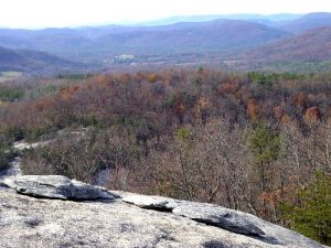
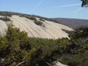
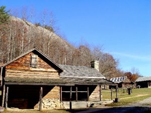
| Hike Summary: | Trip Report Summary: Hike: Stone Mountain Trailhead: Campground Parking area off of Frank Parkway Routing: Stone Mt. Connector Trail to Stone Mt. Loop Trail to Wolf Rock Trail to Cedar Rock Trail back to Stone Mt. Loop Trail return to the trailhead via Stone Mt. Connector Trail Direction Summary: Located off US21 and I-77, North of Winston-Salem NC Distance: Total distance 7-8 miles (approx) Elevation Gain: 800 +/- feet Trail condition: Excellent. Rocky surface along trails. Stone Mt. is solid rock. Trail up to Stone Mt. newly rebuilt with wide paths and switchbacks. Trail off backside of Stone Mt. is very steep 700ft drop in about a mile. Park Service actively building switchbacks and stairs down backside of mountain. "Caution" only for strong hikers, a slip turns into a long fall with nothing to hold on to many spots. See my trail pics on RRHMG website. Lots of stairs to climb at the end of hike near Stone Mt. Falls. Looks like the Great Wall of China because they are so long. Highlights: All trails have lots of 10ft tall rhododendron, giant rocks, running streams and lots of mountain laurel along the trailway. Great views to the south and west, I could see Grandfather Mt. (42 miles) and Mount Mitchell (83 miles away), 200ft tall Stone Mt. Waterfall with multiple level viewing platforms is wonderful. Two smaller waterfalls Middle and Lower off main trail are nice to see. 1800's era Hutchison Family Farm in valley below mountain is well preserved and very educational. Wolf Rock has nice forest view, trail has unusual trees and plants and Cedar Rock has great view of Stone Mt. with lots of rock climbers on the lower half of the mountain. Meadow at the end of hike was full (20+) of deer around 3PM. Park would be a great spot to view the fall colors from the top. Overall a great day hike with lots to see and do, very crowded during fall. Suitability Rating Leaders: Intermediate to Advanced. Trails well marked and maintained, typical NC Park standards. Blazes are painted on the rock surface on Stone Mt. and are not always easy to follow, Group: Intermediate to Advanced. Most Trails rated Strenuous with some moderate Pitfalls: Watch out for sudden drop offs/cliffs at top. Backside of Stone Mountain is not for weak hikers or folks with vertigo. A fall there could be 100ft down with serious injuries. Other trails are challenging but not to difficult for an Intermediate hiker. |
Recommended
Trip Reports
There are no Trip Reports yet.


 Trail Map For This Area
There are no comments yet.