Shining Rock via Shining Creek - Member Hike
| Hike Name: | Shining Rock via Shining Creek |
|---|---|
| Country: | United States |
| State: | North Carolina |
| Nearby Town: | Brevard, NC |
| Rating: |  |
| Directions: | From Brevard, NC take US-64 into the entrace of Pisgah National Forest onto 276. Take 276 all the way up to the Blue Ridge Pkwy and continue UNDER(do not get on the Parkway) the Blue Ridge Pkwy dropping down to the Big East Fork parking area which will clearly be on your left. |
| Total Hike Distance: | 6.80 miles |
| Hike Difficulty: | Moderate to Difficult |
| Permit Required: | No |
| Hike Type: | In & Out, Backtrack Hike |
| Hike Starts/Ends: | Big East Fork parking area |
| Trails Used: | Shining Creek, (Art Loeb) |
| Backcountry Campsites: | Yes |
| Backcountry Water Sources: | Streams, Rivers, Springs |
| Management: | None |
| Contact Information: | Unknown |
| Best Season: | Winter, Spring, Summer, Fall |
| Users: | Hikers, Dogs |
| Road Conditions: | Primary Paved Roads, Secondary Paved Roads |
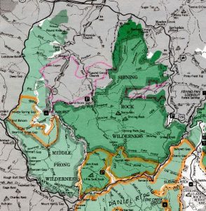
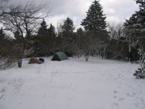
| Hike Summary: | While most people consider this trail "Difficult to Very Difficult", I don't think I would go as far as to say that. It, to me, is only marginally difficult and I first conquered it with my wife and some friends(husband and wife) with it being their first backpacking trip. Didn't hear any complaining out of them until near the end. The trail does climb 2400 feet in 3.4 miles which you really don't especially feel until about the last mile. Most of the trail travels right along with the beautiful Shining Creek with glimpses of small waterfalls here and there further up on the mountain on the right side. Trail is pretty well maintained despite a few downed trees and muddy areas. All campsites on the trail itself are right next to the Creek and all of course on the left side with one large flat area/campsite at around the halfway mark.(You'll know it when you see it) This site would make for an excellent camp/rest point as the trail toughens after this point. The last mile or so is rocky, steeper, and full of switchbacks. You'll know you're close to the top once you go across a couple of log-bridge crossings and enter into denser forest. Once at the top, my suggestion would be to put your packs down and explore the area around Shining Rock Gap and further down the trail near Flower Knob for campsites to your liking. |
Recommended
Trip Reports
There are no Trip Reports yet.


 Trail Map For This Area
There are no comments yet.