Panther Creek Trail - Member Hike
| Hike Name: | Panther Creek Trail |
|---|---|
| Country: | United States |
| State: | Georgia |
| Nearby Town: | Clarkesville |
| Rating: |  |
| Directions: | Using WAYZ app, type “panther creek trailhead” for exact directions from wherever you are! |
| Total Hike Distance: | 5.50 miles |
| Hike Difficulty: | No Answer |
| Permit Required: | No |
| Hike Type: | In & Out, Backtrack Hike |
| Hike Starts/Ends: | Trailhead on old 441 |
| Trails Used: | Panther Creek trail blaze |
| Backcountry Campsites: | Yes |
| Backcountry Water Sources: | Streams |
| Management: | National Park Service |
| Contact Information: | Unknown |
| Best Season: | Spring, Fall |
| Users: | Hikers |
| Road Conditions: | Primary Paved Roads |
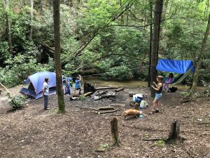
| Hike Summary: | Out and back to waterfalls. Limited parking but many pRk on side of street. Cleared trail, quite a bit of roots, some sections tight and / or drop offs. Overall moderate difficulty. Highly wooded and shaded. Well used paths. Some campsites along the way, but most users of trail are day hikers. |


There are no comments yet.