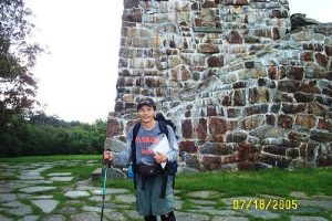
NC Bartram Trail - Wayah to Cheoah Bald - Member Hike
| Hike Name: | NC Bartram Trail - Wayah to Cheoah Bald |
|---|---|
| Country: | United States |
| State: | North Carolina |
| Nearby Town: | Franklin |
| Rating: |  |
| Directions: | Wayah Bald W/NW of Franklin off HWY 64 |
| Total Hike Distance: | 80.00 miles |
| Hike Difficulty: | Moderate to Difficult |
| Permit Required: | No |
| Hike Type: | In & Out, Backtrack Hike |
| Hike Starts/Ends: | Wayah Bald |
| Trails Used: | NC Bartram, Junaluska, London Bald, Appletree, Piercy Creek, others in the Appletree system |
| Backcountry Campsites: | Yes |
| Backcountry Water Sources: | Streams |
| Management: | U.S. Forest Service |
| Contact Information: | http://geocities.com/j3hnr3y/ http://www.ncbartramtrail.org/maps.htm |
| Best Season: | |
| Users: | Hikers |
| Road Conditions: | Maintained Gravel or Dirt Roads, Unmaintained Gravel or Dirt Roads |
| Hike Summary: | I did this solo hike in July 05. I was out 9 days - 8 nights out on the trail. Remnants of Hurricane Dennis were still lingering as I got out of my car in pouring rain atop Wayah Bald. I used the John Ray NC Bartram and Appletree Trail guides for this trip. I greatly enjoyed this trip. Cheoah Bald is beautiful with lots of scenic water on the way up from Winding Stair. That section is pretty steep. Also going from Nantahala Lake back up towards Sawmill Gap is pretty tough! There are some tough ascents on some of the Appletree trails too. You can make a loop by taking the AT back to Wayah Bald but the AT looked so overused compared to the Bartram, I decided I would enjoy backtracking in solitude more. |
Recommended
Trip Reports
There are no Trip Reports yet.


 Trail Map For This Area
There are no comments yet.