Mount Rogers National Recreation Area - Member Hike
| Hike Name: | Mount Rogers National Recreation Area |
|---|---|
| Country: | United States |
| State: | Virginia |
| Nearby Town: | Mouth of Wilson |
| Rating: |  |
| Directions: | From I-77, take Hillsville Exit 14 to U.S. 58. Travel west on U.S. 58, 40 miles to Volney. Turn left to stay on U.S. 58 and go eight miles to the park entrance. |
| Total Hike Distance: | 6.50 miles |
| Hike Difficulty: | Moderate |
| Permit Required: | Yes |
| Hike Type: | Roundtrip, Loop Hike |
| Hike Starts/Ends: | Grayson Highlands overnight parking area |
| Trails Used: | Rhododendron Trail, Appalachian Trail, Rhododendron Gap Trail |
| Backcountry Campsites: | Yes |
| Backcountry Water Sources: | Streams, Springs |
| Management: | National Park Service |
| Contact Information: | Grayson Highlands State Park 829 Grayson Highland Lane, Mouth of Wilson, VA 24363 Phone #: (276) 579-7092 Mount Rogers National Recreation Area Supervisor's Office 5162 Valleypointe Parkway Roanoke, VA 24019 1-888-265-0019 |
| Best Season: | Winter, Spring, Fall |
| Users: | Hikers, Dogs, Horses |
| Road Conditions: | Primary Paved Roads |
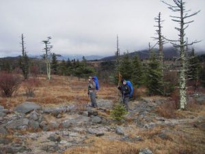
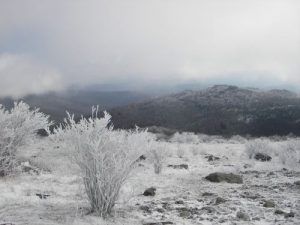
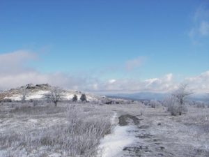
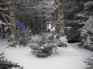
| Hike Summary: | Start this trip at the Grayson Highlands overnight parking area. There is a $2.00 parking fee per night at the park entrance. Grayson Highlands has a collection of balds that stay bald because the vegetation is consumed by "wild" ponies and, occasionally, cattle (I once ran into longhorn cattle grazing on the balds). The "wild" ponies will come right up to you and search for food. They are absolutely beautiful to look at and make me smile everytime I see them. Unfortunately, we did not see any this visit. From the parking lot we took the Rhododendron Trail for 1 mile to the Appalachian Trail. We then went left (south bound) on the AT for 2.5 miles. At Rhododendron Gap, the AT bears to the left and the Pine Mountain Trail comes in from the right. About 3/4 miles on the AT, there are a number of different campsites that are right off the trail. This is a good area for camping. Behind these campsites, off of the Crest Trail (which parallels the AT for a short distance) there is a water source for filling up. It is a spring that is fenced in to keep animals out, although the last time I visited the area, ponies and cows were drinking from the spring down stream from where I was. The hike from start to the campsite is a steady, although not necessarily steep, ascension up the Wilburn Ridge. We had spent the night in this area, since it is one of the few areas that have water nearby. On the way back, we cut through the campsites and went across the Crest Trail to the Rhododendron Gap Trail. This is a rocky trail that is very eroded. During times of rain, or snow, the trail is usually flooded. At about 3/4 mile, the Rhododendron Gap Trail crosses the AT. There are no blazes on this section of the trail and it may be hard to follow at times. At about another 3/4 mile, it meets up with the AT again. Follow the AT northbound for a few thousand feet and take the Rhododendron Trail back to the parking lot. |


There are no comments yet.