Masada - Snake Path - Member Hike
| Hike Name: | Masada - Snake Path |
|---|---|
| Country: | Israel |
| Region: | Dead Sea |
| Nearby Town: | Ein Gedi |
| Rating: |  |
| Directions: | Take the Egged bus from Jerusalem to Ein Gedi, an oasis near the west shore of the Dead Sea. From Ein Gedi, take a local Egged bus to Masada’s east entrance. |
| Total Hike Distance: | 5.00 miles |
| Hike Difficulty: | Moderate |
| Permit Required: | No |
| Hike Type: | In & Out, Backtrack Hike |
| Hike Starts/Ends: | East Visitor Center - Masada National Park |
| Trails Used: | Snake Path |
| Backcountry Campsites: | No |
| Backcountry Water Sources: | None |
| Management: | Other |
| Contact Information: | Unknown |
| Best Season: | Winter, Spring, Fall |
| Users: | Hikers |
| Road Conditions: | Primary Paved Roads |
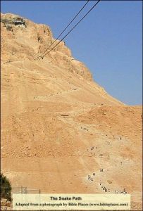
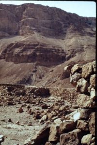
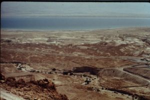
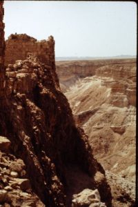
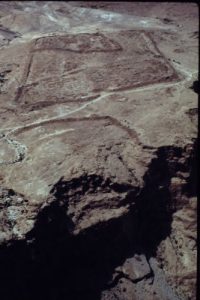
| Hike Summary: | The east entrance to Masada has an aerial tram running to the top of the mountain fortress. This is, of course, the easy way up. Most tourists to Masada use the aerial tram for the roundtrip, many for the trip up only, returning down the Snake Path, and relatively few use the Snake Path for both up and down. Any fit hiker should have no problem making it up and back on the Snake Path. A note of warning: the Snake Path is a narrow, steep, climb up a shear mountain face, and is entirely exposed to the sun. Be prepared by wearing a hat and bringing sufficient water. Finally, start early before the heat of the day – and it gets very hot here during most of the year. From the east visitor center, cross the access road, and follow the signs across the wadi and past the ancient Roman fort. The trail begins to ascend as soon as you are across the wadi, although the first leg of approximately 0.5 mi is not steep. The grade increases after that and begins switching back before you are above the loose rock at the base of Masada. Once above the loose rock, much of the trail becomes steps cut into the shear face of the rock wall that made Masada such a formidable fortress. The top of Masada is 1200’ above the trailhead. At the top of the mountain, one can spend several hours touring the ancient ruins. Don’t miss Herod’s Palace and baths at the north end of the mountain, the Roman siege ramp on the west side of the mountain, and the cisterns throughout. |


One reply on “Masada - Snake Path - Member Hike”
I ran the Snake Path upwards in April 1976, midday. I was with friends that took the tram and it took four trips to get our party all up to the top. By the time I arrived, they were ready to return, so I didn’t get to spend much time looking around. The cistern really impressed me. A once in a life-time experience.