Great Smoky Mountains National Park – Clingmans Dome to Silers Bald - Member Hike
| Hike Name: | Great Smoky Mountains National Park – Clingmans Dome to Silers Bald |
|---|---|
| Country: | United States |
| State: | North Carolina |
| Nearby Town: | Cherokee, NC |
| Rating: |  |
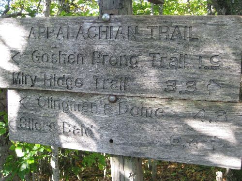
| Directions: | From Cherokee, NC drive US441 north, or from Gatlinburg, TN drive US441 south, about 20 miles to Newfound Gap, which is right on the border between the two states. The road to Clingmans Dome is 0.2 mi from Newfound Gap on the North Carolina side. Turn onto the Clingmans Dome Road and drive 8 miles to the parking area at the trailhead. At the trailhead, the right trail goes to the observation platform on the top of Clingmans Dome, the left trail goes to Forney Ridge and the Clingmans Dome Bypass trail. |
| Total Hike Distance: | 9.40 miles |
| Hike Difficulty: | Moderate |
| Permit Required: | No |
| Hike Type: | In & Out, Backtrack Hike |
| Hike Starts/Ends: | Clingmans Dome Trail Head |
| Trails Used: | Clingmans Dome Trail, Appalachian Trail, Clingmans Dome Bypass Trail |
| Backcountry Campsites: | Yes |
| Backcountry Water Sources: | Springs |
| Management: | National Park Service |
| Contact Information: | Great Smoky Mountains National Park 107 Park Headquarters Rd. Gatlinburg, TN 37738 865-436-1200 www.nps.gov/grsm |
| Best Season: | Spring, Summer, Fall |
| Users: | Hikers |
| Road Conditions: | Primary Paved Roads, Secondary Paved Roads |
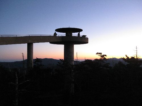
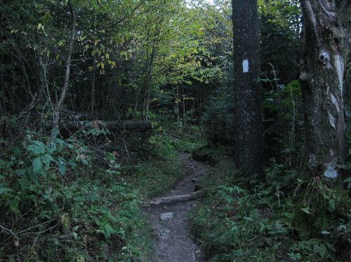
| Hike Summary: | Follow the paved trail to Clingmans Dome 0.5 mi (it climbs 330 feet to the summit at 6600 feet). The observation tower on top of Clingmans Dome affords a 360 degree view of the Great Smokies and is a great place from which to watch the sunrise or sunset. At the bottom of the spiral ramp to the observation tower is a short connector trail that takes you over to the Appalachian Trail. Turn left onto the Appalachian Trail. Follow the Appalachian Trail (marked by white blazes) 4.3 miles to the junction with the Welch Ridge Trail and then turn right for the final 0.4 mi to the top of Silers Bald. The trail generally descends for most of the 4.7 miles to Silers Bald, as Silers Bald is 1000 feet lower in elevation, but there are five knobs in between Clingmans Dome and Double Spring Gap, which sits 1100 feet lower than the Dome. Each knob has a bit of uphill to accomplish. After passing the shelter at Double Spring, the trail passes over two more knobs before descending to a narrow ridge, appropriately called The Narrows to the trail’s low point at 5300 feet. Then it climbs 300 feet up to the top of Silers Bald. Return the same way. If you don't want to climb to the top of Clingmans Dome again on the return, take the Clingmans Dome Bypass trail about 0.5 mi below the summit and it will return you to the parking lot at the trailhead after it joins the Forney Ridge Trail. |


 Trail Map For This Area
There are no comments yet.