Grassy Mtn Tower - Member Hike
| Hike Name: | Grassy Mtn Tower |
|---|---|
| Country: | United States |
| State: | Georgia |
| Nearby Town: | Eton |
| Rating: |  |
| Directions: | From Chatswroth go N on 411 for 4.1 miles to Eton. Turn Right onto CCC Camp Road for 10 miles to FR 68. Follow FR 68 to FR 49 (keep veering left to stay on 68) at 11 miles. Follow .3 miles to Conasauga Overflow campground parking lot. |
| Total Hike Distance: | 4.60 miles |
| Hike Difficulty: | Moderate |
| Permit Required: | No |
| Hike Type: | In & Out, Backtrack Hike |
| Hike Starts/Ends: | Songbird Trail Head |
| Trails Used: | Songbird Trail, Grassy Mountain Tower Trail |
| Backcountry Campsites: | Yes |
| Backcountry Water Sources: | Streams |
| Management: | State Forest Service |
| Contact Information: | Cohutta Wilderness Managment |
| Best Season: | Winter, Spring, Summer, Fall |
| Users: | Hikers, Dogs |
| Road Conditions: | Primary Paved Roads, Secondary Paved Roads, Maintained Gravel or Dirt Roads, Unmaintained Gravel or Dirt Roads |
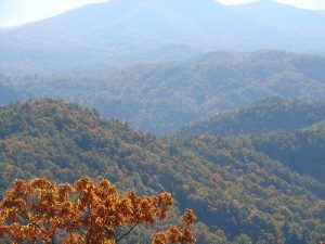
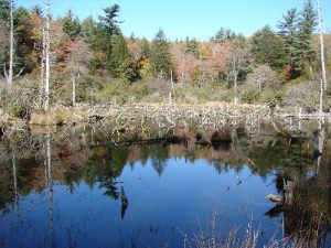
| Hike Summary: | Trail begins at songbird trail head near campsite 3 at Conasauga overflow campground. Follow relatively level trail past beaver dams and small streams for 0.9 miles. Come to split of Grassy Mtn Tower trail to right, songbird trail continues left. Follow GMTT for 1.8 miles to FR 49 (no vehicles allowed). Follow FR 49 for .4 miles to Tower. Tower upper deck closed but can climb stairs to see great views of Fort Mtn and Cohutta Wilderness. Backtrack to split and turn right (now on small loop of songbird trail. Will circle you back around to the part of songbird trail you started on, follow back to parking lot. *our GPS said 5.2 miles, book said 4.6 miles. |
Recommended
Trip Reports
There are no Trip Reports yet.


There are no comments yet.