Glacier National Park - Dawson / Pitamakan Pass Loop - Member Hike
| Hike Name: | Glacier National Park - Dawson / Pitamakan Pass Loop |
|---|---|
| Country: | United States |
| State: | Montana |
| Nearby Town: | Kalispell |
| Rating: |  |
| Directions: | From Kalispell, Montana, take US 2 East. Continue to follow US 2 for approximately 87 miles and turn left on Montana 49. Go 4.1 miles and turn onto Two Medicine Road. Take Two Medicine Road for another 7.3 miles to the Two Medicine Lake boat dock. |
| Total Hike Distance: | 20.60 miles |
| Hike Difficulty: | Moderate to Difficult |
| Permit Required: | Yes |
| Hike Type: | Roundtrip, Loop Hike |
| Hike Starts/Ends: | Two Medicine Lake Boat Dock |
| Trails Used: | South Shore Trail, Dawson Pass Trail, Pitamakan Pass Trail |
| Backcountry Campsites: | Yes |
| Backcountry Water Sources: | Streams, Lakes |
| Management: | National Park Service |
| Contact Information: | Glacier National Park Park Headquarters P.O. Box 128 West Glacier, Montana 59936 Phone: (406) 888-7800 Fax: (406) 888-7808 www.nps.gov/glac/index.htm |
| Best Season: | Summer |
| Users: | Hikers, Horses |
| Road Conditions: | Primary Paved Roads |
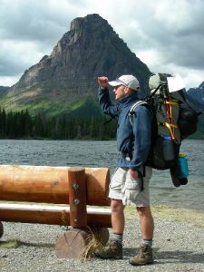
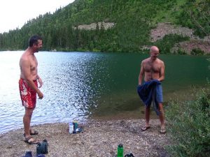
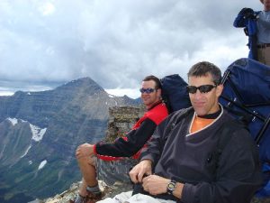
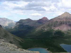
| Hike Summary: | The area that is now Glacier National Park was first made a Forest Preserve in 1900, and was later established as the country’s tenth national park in 1910. Glacier and the adjacent Waterton Lakes National Park to the north in Canada were named as a World Heritage Site in 1995. Glacier alone offers over 700 miles of trails, which afford incredible views of spectacular mountain sides and glacial valleys, unspoiled alpine lakes and forests, and a variety of wildlife. This particular hike begins at the Two Medicine Lake boat dock, and travels southwest, then northwest, along the fairly level terrain of the South Shore Trail. Approximately one mile in, there is an in-and-out side trail to Aster Falls, which is definitely worth taking, especially if you get a late morning start and want a good place to stop for lunch. This side trail will add approximately 1.4 miles to the overall trip (i.e. 0.7 miles in and 0.7 miles out). After approximately 4.1 miles from the trailhead, the South Shore Trail connects with the Dawson Pass Trail (to the west) and the North Shore Trail (to the east). The hike continues on the Dawson Pass trail to the west, and ascends approximately 700 feet to No Name Lake, the site of the first backcountry campsite. The lake, shadowed by the sheer walls of Pumpelly Pillar to the south and west, is a wonderful place to relax and watch for wildlife. There is also a boulder field at the base of Pumpelly Pillar just to the west of the campsite that is fun to scramble around on. From No Name Lake, the hike continues west up to Dawson Pass, and then north to Pitamakan Pass along the continental divide. The hike from No Name Lake to Dawson Pass gains approximately 1,650 feet over 1.9 miles, and then remains fairly level between Dawson Pass and Pitamakan Pass. The winds at each of these two passes, and at a few of the more exposed areas in between, are incredible, but the views are spectacular. This is by far the highlight of the trip. From Pitamakan Pass, the trail descends approximately 900 feet over 2 miles to Oldman Lake, the site of the second backcountry campsite. Oldman Lake sits in a huge bowl formed in part by the ridge of the continental divide to the west. It is an awesome place to sit and absorb the pristine views while sucking up water and bullshitting with friends. From Oldman Lake, the hike continues east, and finally south, losing just over 1,500 feet of elevation over the 5.9 miles to the Two Medicine auto campground. From the auto campground, another 0.5 miles (plus or minus) of hiking is required on campground roads to get back to the Two Medicine Lake boat dock. The scenery along this last 6.4 miles of the hike pales in comparison to that along the continental divide, but would be beautiful in its own right on any given day. |


5 replies on “Glacier National Park - Dawson / Pitamakan Pass Loop - Member Hike”
Whoops, sorry about that. db and CJ are correct on the directions. According to Google Maps, it is 98.4 miles (2 hours 9 mins) each way from Kalispel to Two Medicine Lake. Not sure what was going on there. It’s been corrected.
Backcountry campsight is infested with horse flies. Absolutely require headnet. They are relentless.
Hike itself is great. The lake has been ruined by the NPS allowing horses up this trail.
db is right. These driving directions are bunk. there are a LOT of omitted miles on hwy 2 there. I’d say 100 miles roundtrip (from Kalispell) is a fair guess. But the actual hike… It’s amazing. I’m giving the article 1 star, but I’d give the hike 4, and I’m a local, and I’m particular.
Note on driving directions … it is more than 100 miles from Kalispell to the 2Med boat dock.
Glacier’s backcountry and hiking trails have grown in popularity over the years, heightening the need for visitor stewardship and sound backcountry practices.
Before heading out backpacking, please stop by one of the park’s staffed backcountry offices or ranger stations to pick up your required backpacking permit. Rangers will be able to assist you with your trip planning, including trail status conditions, bear sightings, and Leave No Trace principles.