Fork Mountain Trail- Sloan’s Bridge to Burrell’s Ford - Member Hike
| Hike Name: | Fork Mountain Trail- Sloan’s Bridge to Burrell’s Ford |
|---|---|
| Country: | United States |
| State: | South Carolina |
| Nearby Town: | Highlands NC |
| Rating: |  |
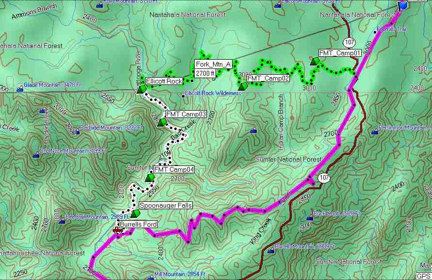
| Directions: | Burrell’s Ford- Go north 8.5 miles from Walhalla, SC on Hwy 28 to SC 107. Go right on 107 for 8.9 miles to FR 708 (gravel). Left on FR 708 for 3 miles to Burrells Ford parking area. Sloan’s Bridge- Go back out to Hwy 107 and turn left. Go about 6 miles. Wiggington Road comes into Hwy 107 from the right. Sloan’s Bridge Picnic Area is just past that, on the left. |
| Total Hike Distance: | 12.00 miles |
| Hike Difficulty: | Moderate |
| Permit Required: | No |
| Hike Type: | One-Way, Shuttle Hike |
| Hike Starts: | Sloan's Bridge Picnic Area |
| Hike Ends: | Burrell's Ford Parking Lot |
| Trails Used: | Fork Mountain Trail, Chatooga River Trail |
| Backcountry Campsites: | Yes |
| Backcountry Water Sources: | Streams, Rivers |
| Management: | U.S. Forest Service |
| Contact Information: | Sumter NF 810 Buncombe ST Edgefield,SC 29824 Phone: (803) 637-5396 http://www.fs.fed.us/r8/fms/forest/recreation/ Nanathala NF Nantahala Ranger District 90 Sloan Rd. Franklin, NC 28734 (828) 524-6441 |
| Best Season: | Spring, Fall |
| Users: | Hikers |
| Road Conditions: | Primary Paved Roads, Maintained Gravel or Dirt Roads |
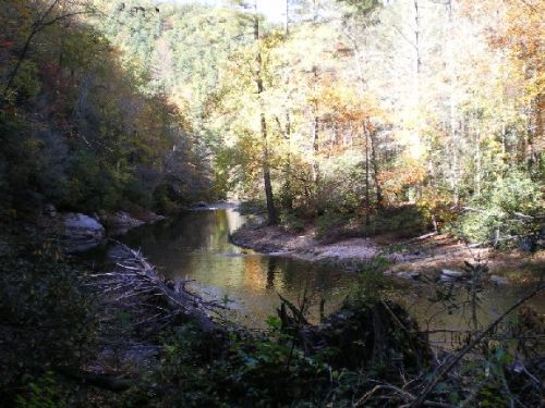
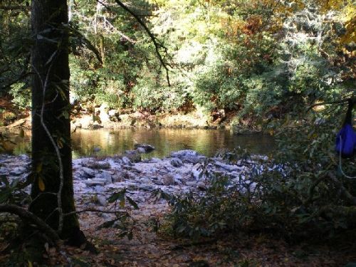
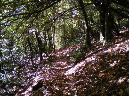
| Hike Summary: | This hike was Oct. 25, 26, 2008. Weather was beautiful. High 65 degrees, low 37 degrees. We dropped one car off at the Burrell’s Ford Campground and then drove to Sloan’s Bridge to start. We hit the woods at 10:00 Saturday morning. The Fork Mountain Trail starts about 50 yards north of the Sloan’s Bridge Picnic Area and goes west. There should be a red-orange blaze on this trail, but I never saw one. Fortunately, the trail was in very good shape and the lack of blazes was not a problem. There is a nice small campsite just about a mile in, right next to a small creek. At the 3.4 mile mark is a very nice large campsite. The trail is mostly downhill all the way to the Chatooga River, 7.7 miles from the start. You will hit the Chatooga at a large campsite, about .2 miles north of Ellicott Rock. Turn south and walk along the river past Ellicott Rock. The next 20-30 minutes is the most difficult section to hike. A lot of roots and rocks on the trail make for very difficult footing. About a mile from the Rock, there is a beautiful campsite next to the river, where we stopped for the day. 10 minutes later, a second, larger one. All of the campsites we saw had rocks or logs to sit on, nice stone fire rings. Hard to call it primitive. Temp was around 37 degrees the next morning. Got the campfire going again, put on some coffee. Since we had hiked about 8.5 miles the first day, we only had 3.5 to get to the car, so we were in no hurry to leave. We spent the morning relaxing by the river and started out at 1:00. It was a beautiful, though uneventful hike out. We took our time, checked out every campsite on the way and detoured to Spoonauger Falls. It is only 0.1 miles off the trail and worth the hike. We got to the car around 3:00. I will definitely do this again. Another option for a day hike is to park at Burrell’s Ford, hike in to one of the campsites and just spend the day by the river. Fish a little, nap, drink coffee, eat, life is good. |
Recommended

 Trail Map For This Area
Trip Reports
| Date | Rating | Duration | Hiker | |
|---|---|---|---|---|

|
November 9, 2007 |  |
2 days | hikingdiva |

|
October 25, 2008 | |
2 days | swampfox |
There are no comments yet.