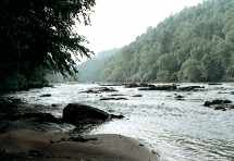
Fisherman's Trail - Member Hike
| Hike Name: | Fisherman's Trail |
|---|---|
| Country: | United States |
| State: | Tennessee |
| Nearby Town: | Tellico, Etowah, Benton |
| Rating: |  |
| Directions: | Directions From Tellico Plains: From the Hiawassee District Office, turn left onto Mecca Pike -(Highway 310) and proceed .8 miles to the traffic light. Turn left onto Highway 411 and continue south for 7.4 miles. Turn left onto Highway 30 east and travel for 1.6 miles to the Hiawassee State Scenic Parking Area on the left. |
| Total Hike Distance: | 3.00 miles |
| Hike Difficulty: | Easy |
| Permit Required: | No |
| Hike Type: | In & Out, Backtrack Hike |
| Hike Starts/Ends: | Hiawassee State Scenic Parking Area |
| Trails Used: | Fisherman's Trail |
| Backcountry Campsites: | No |
| Backcountry Water Sources: | Streams, Rivers, Springs |
| Management: | National Park Service |
| Contact Information: | http://www.mountaintravelguide.com/HikingTrails/Tennessee/mcminn/Fisherman'sTrail.htm |
| Best Season: | Winter, Spring, Summer, Fall |
| Users: | Hikers |
| Road Conditions: | |
| Hike Summary: | The trail follows the Hiawassee River with excellent fishing spots. Hikers can view the variety of flora along the river. This is another hike that I've completed about a gazillion times as a boy which included healthy doses of swimming when it got hot. This is an easy, easy, hike and great for youngsters but you do need to watch out for Mr. No Shoulders all along the trail, especially Water Moccasins. |


There are no comments yet.