Dukes Creek Falls - Member Hike
| Hike Name: | Dukes Creek Falls |
|---|---|
| Country: | United States |
| State: | Georgia |
| Nearby Town: | Dahlonega, GA |
| Rating: |  |
| Directions: | Directions from Helen, GA - Travel Hwy. 75 out of Helen, Ga. - Go 1.5 miles to Ga. Hwy 75 Alt.and turn left. - Proceed 2.2 miles and turn right onto Richard Russell Scenic Highway (Ga. 356). - Continue 2 miles and look for the entrance to the parking area on the left. |
| Total Hike Distance: | 1.20 miles |
| Hike Difficulty: | Easy |
| Permit Required: | Yes |
| Hike Type: | In & Out, Backtrack Hike |
| Hike Starts/Ends: | Richard Russell Scenic Highway |
| Trails Used: | None |
| Backcountry Campsites: | No |
| Backcountry Water Sources: | Streams |
| Management: | State Park Service |
| Contact Information: | Unknown |
| Best Season: | Winter, Spring, Summer, Fall |
| Users: | Hikers, Dogs |
| Road Conditions: | Primary Paved Roads |
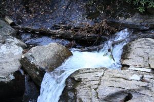
| Hike Summary: | Dukes Creeks Falls is a great 1.2 mile hike one way for a family. This waterfall has a series of observation decks and spectacular awe factor. Davis Creek and Dodd Creek form Dukes Creek. The falls drops approximately 200 feet. Viewing of the falls has been made safer and easier by a well maintained, wide traversing trail with steps on the steep sections. Deep woods, beautiful ferns, and fauna follow the trail making it a relaxing and enjoyable trek into Dukes Creek Gorge. Once at the Gorge, a series of boarded walkways connect three observation decks where you'll have nice views of the waterfall on the three creeks. If you choose not to walk the mile down to the gorge, you'll find an observation deck less the 1/10th of a mile down the trail which has a distant view of the falls. By driving an additional half mile past the access to the top of the falls a ford across Davis Creek is reached. Park just across the ford and walk upstream 100 yds to still another waterfall. Proceed 200 yards to reach the top of the falls. A little further above Dukes Creek Falls is yet another falls to check out. **SPECIAL NOTE** There are no handicap ramps once you get further down the trail and part of the trail is not paved. |
Recommended
Trip Reports
There are no Trip Reports yet.


There are no comments yet.