Coppermine Loop - Fundy National Park - Member Hike
| Hike Name: | Coppermine Loop - Fundy National Park |
|---|---|
| Country: | Canada |
| Province: | New Brunswick |
| Nearby Town: | Alma |
| Rating: |  |
| Directions: | Fundy National Park is located near the Village of Alma, New Brunswick, on provincial Highway 114. The nearest bus terminals are in Sussex and Moncton. Airports are located in Moncton, Saint John and Fredericton. The closest US airport is in Bangor, Main. By car from Fredericton: take Trans-Canada Highway 2 east towards Moncton, turn south at exit 365 at Coles Island on to highway 10. This will take you to Sussex. At Sussex follow highway 1 towards Moncton. Then take Route 114 at exit 211. By car from Saint John: take Highway 1 east towards Moncton. Then take Route 114 at exit 211. By car from Moncton: head southwest on Highway 114. There is no public transportation directly to or from the park A good general website for the area, including information about the park is: http://www.fundyweb.com/fundy/ |
| Total Hike Distance: | 3.50 miles |
| Hike Difficulty: | Easy to Moderate |
| Permit Required: | No |
| Hike Type: | One-Way, Shuttle Hike |
| Hike Starts: | Parking area - end of Pointe Wolfe Rd. |
| Hike Ends: | Parking area - end of Pointe Wolfe Rd. |
| Trails Used: | Coppermine Loop , Pointe Wolfe Beach Trails |
| Backcountry Campsites: | No |
| Backcountry Water Sources: | Streams, Rivers |
| Management: | National Park Service |
| Contact Information: | Fundy National Park P.O. Box 1001 Alma, NB E4H 1B4 A good general website for the area, including information about the park is: http://www.fundyweb.com/fundy/ |
| Best Season: | Spring, Summer, Fall |
| Users: | Hikers |
| Road Conditions: | Primary Paved Roads, Secondary Paved Roads |
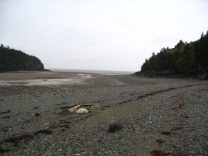
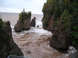
| Hike Summary: | Fundy National Park of Canada, with 206 square kms., encompasses some of the last remaining wilderness in southern New Brunswick. Here, the conifer dominated Caledonia Highlands roll down to meet the fog-generating Bay of Fundy. The tidal fluctuation of the Bay of Fundy is the highest in the world. Watch fishing boats come and go to the rhythm of the bay. Inland, explore lush forests and deep stream valleys. Fundy is open year round. However, many services and facilities open only during the summer season. The park charges a fee during the summer season but, while open for access to hiking trails, etc., all park services close for the winter and no fee is charged after Canadian Thanksgiving. The fishing village of Alma is at the entrance to the park where the Salmon river empties into the bay of Fundy. Alma offers the nearest hotel and restaurant services. However, most places close after Canadian Thanksgiving and services, while available, are extremely limited in the winter months. Fishing boats have access to the bay only at high tide. Tides here are on the order of 40 feet and the water recedes over a half mile from high to low tide. Fishing boats sit on cradles by their docks at low tide and wait to be floated at high tide. Fishermen, of necessity, have a 12 hour work cycle between high tides. Another popular spot on the Bay of Fundy, Hopewell rocks, is just a short drive up the coast. We were only there one full day in October and the weather was lousy but we managed to hike the following two trails in the park during a howling Nor’easter. We were soaked and cold when we finished but it was worth it. Coppermine Loop Trail = 2.75 Mile loop – Small footbridges over mossy brooks. Cool shaded forest to an old mine site then back along the coast with great views of the bay. Pointe Wolfe Beach Trail (in & out) = .8 Mile - Descent on a wooden walkway to a beach where the Pointe Wolfe river empties into the bay. A great place to visit at low tide, then at high tide to see the contrast. |


There are no comments yet.