Congaree National Park - Member Hike
| Hike Name: | Congaree National Park |
|---|---|
| Country: | United States |
| State: | South Carolina |
| Nearby Town: | Gadsen |
| Rating: |  |
| Directions: | Congaree National Park is located about 20 miles from downtown Columbia, South Carolina in the Hopkins / Gadsden community. Directions to the park are as follows: From CAE - Columbia Metropolitan Airport. (Approx. 24 miles) At the airport exit, go right on the ramp following signs labeled “TO SC 302/Columbia. Follow this road (John Hardee Expressway) until it ends at SC 302 (Airport Blvd.) Turn left onto SC 302 East toward Columbia. Drive approximately one mile, and turn right onto Interstate 26 East, toward Charleston. At Exit 116, turn onto Interstate 77 North towards Charlotte (LEFT EXIT). Continue on Interstate 77 for approximately five miles to exit 5. Follow directions below from I 77, Exit 5. From Spartanburg (Approx. 115 miles) Follow Interstate 26 East (towards Charleston) to Exit 116. At Exit 116, turn onto Interstate 77 North towards Charlotte (LEFT EXIT). Continue on Interstate 77 for approximately five miles to Exit 5. Follow directions below from I 77, Exit 5. From Charleston (Approx. 114 miles) Follow Interstate 26 West (towards Spartanburg) to Exit 116. Turn onto Interstate 77 North towards Charlotte. Continue on Interstate 77 for approximately five miles to exit 5. Follow directions below from I 77, Exit 5. From Charlotte (Approx. 110 miles) Take Interstate 77 South for approximately 95 miles to Exit 5. Follow directions below from I 77, Exit 5. From Interstate 77, Exit 5 At Exit 5 turn off onto SC Hwy 48 East (Bluff Rd.), following the brown and white Congaree National Park directional signs. Travel southeast approximately fourteen miles on SC Hwy 48 (Bluff Rd.) toward Gadsden and turn right onto Mt. View Rd. Follow Mt. View Rd. for 0.8 miles. Turn right onto Old Bluff Rd. and travel 0.6 miles. At the large park entrance sign, turn left onto the park entrance road and proceed one mile to the Harry Hampton Visitor Center. Parking lots will be on the right. From St. Matthews / Hwy 601 Follow Hwy 601 North to the intersection with Bluff Road (SC Hwy 48). Turn left onto Bluff Road. Follow Bluff Road for 11 miles, until you see the brown and white Congaree National Park directional sign. Immediately after the sign, turn left onto Mt. View Road. Follow Mt. View Rd. for 0.8 miles. Turn right onto Old Bluff Rd. and travel 0.6 miles. At the large park entrance sign, turn left onto the park entrance road and proceed one mile to the Harry Hampton Visitor Center. Parking lots will be on the right. |
| Total Hike Distance: | 33.00 miles |
| Hike Difficulty: | Easy to Moderate |
| Permit Required: | No |
| Hike Type: | Roundtrip, Loop Hike |
| Hike Starts/Ends: | Harry Hampton Visitor Center |
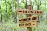
| Trails Used: | River Trail, Oak Ridge Trail, Kingsnake Trail, Bluff Trail, Weston Lake Trail, Boardwalk Loop Trail. |
| Backcountry Campsites: | Yes |
| Backcountry Water Sources: | Streams, Springs |
| Management: | National Park Service |
| Contact Information: | By Mail Congaree National Park 100 National Park Road Hopkins, SC 29061-9118 By Phone Visitor Information 803-776-4396 By Fax 803-783-4241 http://www.nps.gov/cong/ |
| Best Season: | Winter, Spring, Summer, Fall |
| Users: | Hikers |
| Road Conditions: | Primary Paved Roads, Secondary Paved Roads |
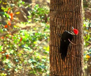
| Hike Summary: | Boardwalks Length: 2.4 miles Time: 1.2 hours Elevated Raised nearly 6 feet above the forest floor, the Elevated Boardwalk winds through a diverse old-growth forest. Use the self-guided brochure and listen for woodpeckers hammering away in the tall trees above. The Elevated Boardwalk ends at Weston Lake, an old channel of the Congaree River. Low The Low Boardwalk passes through a primeval bald cypress and water tupelo forest. Cypress "knees" protrude from the forest floor creating a mystical aura. The knees, part of the tree's root system, are thought to help aerate the roots and to help anchor the cypress in the area's wet soil. Bluff Trail Length: 0.7 miles Time: 0.4 hours Blaze Color: Blue Bluff trail provides access to the elevated boardwalk and the campground. The "bluff" is a small rise on the edge of the floodplain. This trail passes through a young plantation forest of loblolly pines. Weston Lake Loop Trail Length: 4.6 miles Time: 2.3 hours Blaze Color: Yellow Following a cypress-tupelo slough, this loop traverses an old-growth forest. As you walk along the northern bank of Cedar Creek, wildlife, such as river otters, can be spotted playing in the creek's dark waters. Oakridge Trail Length: 7.5 miles Time: 3.8 hours Blaze Color: Red The Oakridge trail passes through a rich stretch of old-growth forest and is a good choice for those in search of a moderate hike. Along the way, the trail crosses a number of "guts" or small creeks that carry floodwaters into and out of the park. Large oaks abound! King Snake Trail Length: 11.1 miles Time: 5.6 hours Blaze Color: Orange The King Snake Trail explores a remote part of Congaree. The trail offers excellent birdwatching, and hikers may spot deer, raccoons, opossums, and even bobcat tracks. Midway, the trail passes a large cypress-tupelo slough that seems to go on forever. On the other side of the trail, giant cherrybark oaks stand at near-record size. River Trail Length: 10.4 miles Time: 5.2 hours Blaze Color: White This trail takes you to the Congaree River, the lifeblood of the area's great natural diversity. About ten times a year, floodwaters from the river cover the park. Because much of the forest along the River Trail was logged prior to the park's establishment, the vegetation here gives you a view of a forest in successional stages. |


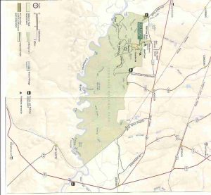
 Trail Map For This Area

There are no comments yet.