Conasauga Falls Trail - Member Hike
| Hike Name: | Conasauga Falls Trail |
|---|---|
| Country: | United States |
| State: | Tennessee |
| Nearby Town: | Coker Creek |
| Rating: |  |
| Directions: | take 68 into Coker Creek, look for the sign. |
| Total Hike Distance: | 2.00 miles |
| Hike Difficulty: | Easy to Moderate |
| Permit Required: | No |
| Hike Type: | In & Out, Backtrack Hike |
| Hike Starts/Ends: | at trailhead |
| Trails Used: | Conasauga Falls Trail |
| Backcountry Campsites: | No |
| Backcountry Water Sources: | Streams |
| Management: | State Park Service |
| Contact Information: | Unknown |
| Best Season: | Winter, Spring, Summer, Fall |
| Users: | |
| Road Conditions: | Primary Paved Roads, Secondary Paved Roads, Maintained Gravel or Dirt Roads, Unmaintained Gravel or Dirt Roads |
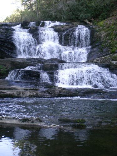
| Hike Summary: | After a long drive on a gravel and treacherous road you arrive at a trailhead with no markers. Take the trail down the ridge and be rewarded with a beautiful secluded waterfall! |


There are no comments yet.