Colby Canyon to Strawberry Peak - Member Hike
| Hike Name: | Colby Canyon to Strawberry Peak |
|---|---|
| Country: | United States |
| State: | California |
| Nearby Town: | La Canada-Flintridge |
| Rating: |  |
| Directions: | Take Angeles Crest Hwy From La Canada Approx. 11 Mi. The Colby Canyon Trailhead is to your left approx 1mi. from The Angeles Crest/Angeles Forest Hwy junction (on Angeles Crest). |
| Total Hike Distance: | 6.50 miles |
| Hike Difficulty: | Moderate to Difficult |
| Permit Required: | No |
| Hike Type: | In & Out, Backtrack Hike |
| Hike Starts/Ends: | At Colby Canyon Trailhead |
| Trails Used: | Colby Canyon Trail to Josephine Saddle, Up a faint climbers trail to peak |
| Backcountry Campsites: | No |
| Backcountry Water Sources: | None |
| Management: | National Park Service |
| Contact Information: | Angeles National Forest 701 N. Santa Anita Avenue Arcadia, CA 91006 626-574-1613 www.r5.fs.fed.us/angeles |
| Best Season: | Winter, Spring, Summer, Fall |
| Users: | Hikers |
| Road Conditions: | Primary Paved Roads |
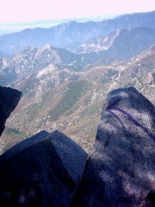
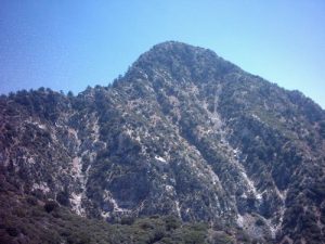
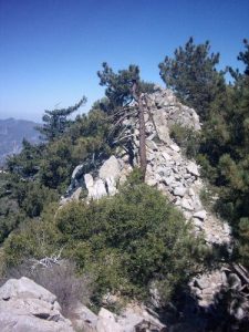
| Hike Summary: | 8-13-05 2600' Elevation Gain #36 In John W. Robinson's Trail of The Angeles This is a great hike if you don't mind a little scramble. There are two sections which require a class three climb up a rocky path. Not beyond the capability of anyone in decent physical conditon, although special care should be taken on the descent. This hike starts at the Colby canyon trailhead, and follows the canyon for a short distance before switchbacking several times to josephine saddle (approx. 1.7mi). The lower part of the canyon has some shade but, it soon disappears once you climb out. An early start is recommended in summer. From Josephine saddle the Colby canyon trail continues North. look for a narrow path just above the trail immediately past the saddle. There should be a purple arrow spray-painted (not sure how I feel about that) on a rock just above the trail junction. From Here folow a faint path (approx 1.1mi) up through fairly dense Chapparral. The Yuccas here are a little nasty. You come to the first climbing section which is fairly easy. Once again the purple arrows are there to guide you if you are unsure. You continue to follow the trail upuntil you reach a small forested area. It looks like a good place to rest. WRONG! I stopped here for two seconds before being tormented by bugs. Keep moving. Beyond the forest You reach some rocky sections. The view is best from this point up to the summit. Climb cautiously but, take in the view as it unfolds. You first going down about 10 feet then up and over about 20 feet. you then climb down again over boulders and travel several yard before reaching the main ascent. This is the hardest section but gives up the best views. Once again not extraordinarily difficult for those in decent shape. It looks much harder than it is. Just take your time and exercise caution. Follow the arrows if necessary. Its about 75 feet up to the summit ridge. The summit itself is small and forested but, you can find views by walking aroud it. I chose to return the way I came, and found the best views are seen descending the rock face to the summit. The climb and views along the way more than make up for the limited view on the summit. Extra care should be taken on the way down. I almost bought the farm on loose gravel. There are many variations of this hike and the peak can be ascended from the west via Red Box without the climb. In my opinion however The Colby Canyon Route gives the best views and a feeling of accomplishment from an actual climb without getting into "rock-climbing". |


There are no comments yet.