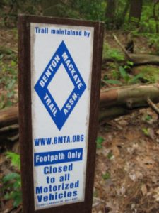
Benton Mckaye Section 3 - Member Hike
| Hike Name: | Benton Mckaye Section 3 |
|---|---|
| Country: | United States |
| State: | Georgia |
| Nearby Town: | Blue Ridge |
| Rating: |  |
| Directions: | Take highway 76 north past Blue Ridge. Turn south on highway 60. Go through Morganton and continue south on highway 60 approximately 10 miles. Pass Skeenah Gap road on the left. There's a camping area there next to Skeenah Creek. The trail crossing is approximately one mile ahead. FS road 816 is on the right. |
| Total Hike Distance: | 7.00 miles |
| Hike Difficulty: | Moderate to Difficult |
| Permit Required: | No |
| Hike Type: | In & Out, Backtrack Hike |
| Hike Starts/Ends: | Highway 60 |
| Trails Used: | Benton McKaye section3 |
| Backcountry Campsites: | No |
| Backcountry Water Sources: | Springs |
| Management: | U.S. Forest Service |
| Contact Information: | http://www.bmta.org/sections/BMT-SecDescrip-03.pdf |
| Best Season: | Winter |
| Users: | Hikers |
| Road Conditions: | Primary Paved Roads |
| Hike Summary: | We started at highway 60 (Tooni Gap) and headed north. Immediately crossed Little Skeenah Creek on a wooden footbridge. Ascended 1000 feet to Wallalah Mountain over several switch backs. Nice overlook at 1.4 miles. One good campsite located at the summit (1.7 miles) and elevation 3100. Descended into gap and ascended 700 feet to Lick Log mountain(3.2 miles) elevation 3472. This is the highest point on section 3. There are several good campsites at the summit. Continued north .3 miles to an unnamed gap. Stopped and enjoyed a cup of hot cider. Only safe water source on section 3 is located 100 yards from the trail at this point. Sign with "W" and arrow points towards the spring. Be sure to follow the trail marked by rectangular blue markers. You will find a small pool of water among the rocks. If I were to camp on this section, this is the place I would choose. The ground is level and there is water nearby. We turned around and headed back. It took about 2 hours to make the return trip of 3.6 miles. Highlights - overlook at mile 1.4 provides great view to the south. Valley is 1000 feet below. This is a strenuous hike with 1400 foot elevation gain in 3.2 miles. Not many people hike this section. We saw only one man with his dog at the start. Later, we saw one man running the trail. They were the only people we saw the entire time. |
Recommended
Trip Reports
There are no Trip Reports yet.


There are no comments yet.