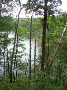
Amadahy Trail - Member Hike
| Hike Name: | Amadahy Trail |
|---|---|
| Country: | United States |
| State: | Georgia |
| Nearby Town: | Ellijay |
| Rating: |  |
| Directions: | Hwy. 282 west from Ellijay. Take second entrance to the WMA Woodring Branch. Trail head a few miles in on the right |
| Total Hike Distance: | 3.41 miles |
| Hike Difficulty: | Easy to Moderate |
| Permit Required: | No |
| Hike Type: | Roundtrip, Loop Hike |
| Hike Starts/Ends: | parking area |
| Trails Used: | Amadahy Trail |
| Backcountry Campsites: | No |
| Backcountry Water Sources: | Streams, Lakes |
| Management: | U.S. Forest Service |
| Contact Information: | Unknown |
| Best Season: | Winter, Spring, Summer, Fall |
| Users: | Hikers, Bikers, Dogs |
| Road Conditions: | Primary Paved Roads, Maintained Gravel or Dirt Roads |
| Hike Summary: | Great over views of Carters Lake |
Recommended
Trip Reports
There are no Trip Reports yet.


There are no comments yet.