Wine Spring Bald - Member Hike
| Hike Name: | Wine Spring Bald |
|---|---|
| Country: | United States |
| State: | North Carolina |
| Nearby Town: | Franklin |
| Rating: |  |
| Directions: | From Franklin, North Carolina, travel west along US for 3.7 miles and turn right at the Wayah Bald sign (onto Old Murphy Road/State Road 1442), then take a left onto State Road NC 1310/Wayah Road). Go 9 miles, and turn right onto unpaved USFS 69 when you reach the Appalachian Trail at Wayah Gap. Follow USFS 69 for 4.3 miles to the end of the gravel road at the Wayah Bald parking area and fire tower. Important ... USFS 69 is closed mid-January through mid-March. |
| Total Hike Distance: | 4.40 miles |
| Hike Difficulty: | Moderate |
| Permit Required: | No |
| Hike Type: | In & Out, Backtrack Hike |
| Hike Starts/Ends: | Wayah Bald |
| Trails Used: | Appalachian/Bartram Trails |
| Backcountry Campsites: | Yes |
| Backcountry Water Sources: | Springs |
| Management: | U.S. Forest Service |
| Contact Information: | Nantahala National Forest Wayah Ranger District Franklin, NC 28734 828-524-6441 |
| Best Season: | Winter, Spring, Summer, Fall |
| Users: | Hikers, Dogs |
| Road Conditions: | Primary Paved Roads, Secondary Paved Roads, Maintained Gravel or Dirt Roads |
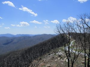
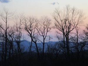
| Hike Summary: | This hike to Wine Spring Bald starts at Wayah Bald and follows the Appalachian Trail southbound for ~2 miles. Here there is a spring to the right of the A.T., and campsites located on both sides of the trail. Wine Spring Bald is also an intersection point for the yellow blazed Bartram Trail which descends to McDonald Ridge. At 5400 feet, the Wine Spring "Bald" is the highest point on the entire Bartram Trail, but don't expect spectacular views since it has been overtaken by trees in recent years. But you can venture 0.5 miles down the Bartram Trail for views from a field at McDonald Ridge. |
Recommended
Trip Reports
There are no Trip Reports yet.


 Trail Map For This Area
There are no comments yet.