Black Gap - Member Hike
| Hike Name: | Black Gap |
|---|---|
| Country: | United States |
| State: | Georgia |
| Nearby Town: | Dahlonega |
| Rating: |  |
| Directions: | From the intersection of GA 400N and US19/GA 60, turn onto US19/GA 60 and head west for 9.3 miles toward Dahlonega and the junction of GA9/GA52. Turn left onto GA9/GA52 and drive 4.3 miles. Here GA 52 breaks from GA 9, so turn right onto GA 52 and continue 7.1 miles to the second sign for Nimblewill Church Road. (There are two signs for Nimblewill Church Road along GA 52 to provide two access points to the church.) At the second sign for Nimbellwill Church Road, turn right and head 1.2 miles to Nimblewill Church. At the stop sign, turn left and head away from the church and up Nimblewill Gap Road which turns to gravel after a few miles. Follow this road 7.3 miles to Nimblewill Gap. The road is rutted and rocky in parts and a high clearance vehicle is mandatory for this area. |
| Total Hike Distance: | 2.60 miles |
| Hike Difficulty: | Moderate |
| Permit Required: | No |
| Hike Type: | In & Out, Backtrack Hike |
| Hike Starts/Ends: | Nimblewill Gap |
| Trails Used: | Approach Trail |
| Backcountry Campsites: | Yes |
| Backcountry Water Sources: | Springs |
| Management: | U.S. Forest Service |
| Contact Information: | Chattahoochee National Forest 508 Oak Street NW Gainesville, GA 30501 (404) 536-0541 |
| Best Season: | Winter, Spring, Summer, Fall |
| Users: | Hikers, Dogs |
| Road Conditions: | Primary Paved Roads, Secondary Paved Roads, Maintained Gravel or Dirt Roads, Unmaintained Gravel or Dirt Roads |
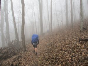
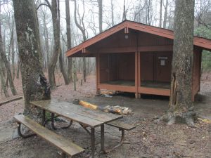
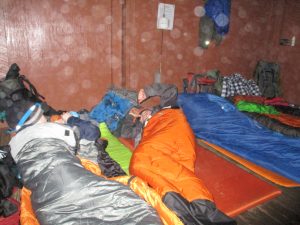
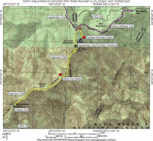
| Hike Summary: | This hike uses the Approach Trail to access Black Gap Shelter from Nimblewill Gap at USFS 28. From here, the trail makes a steep then gradual climb over 1.3 miles to the shelter which sits off the trail and to the left at 3410 feet. The shelter was once located at Springer Mountain but was moved here in the early 90s when the Springer shelter was rebuilt. Black Gap has a spring nearby and can accommodate around 8 hikers. |
Recommended
Trip Reports
There are no Trip Reports yet.


There are no comments yet.