Mauna Kea - Member Hike
| Hike Name: | Mauna Kea |
|---|---|
| Country: | United States |
| State: | Hawaii |
| Nearby Town: | Hilo |
| Rating: |  |
| Directions: | From Hilo, drive west on Saddle Road (Highway 200). Turn right onto the Mauna Kea access road near mile marker 28. |
| Total Hike Distance: | 0.20 miles |
| Hike Difficulty: | Easy to Moderate |
| Permit Required: | No |
| Hike Type: | In & Out, Backtrack Hike |
| Hike Starts/Ends: | Mauna Kea Access Road Near the University of Hawaii 2.2-Meter Telescope |
| Trails Used: | Mauna Kea Summit Trail |
| Backcountry Campsites: | No |
| Backcountry Water Sources: | None |
| Management: | Other |
| Contact Information: | Mailing Address: Maunakea Observatories Support Services 177 Maka'ala Street Hilo, HI 96720-5108 Location: 6 Miles Uphill from Saddle Road (Highway 200) Telephone: (808) 961-2180 Road Conditions: (808) 935-6268 http://www.ifa.hawaii.edu/info/vis/ |
| Best Season: | Spring, Summer, Fall |
| Users: | Hikers |
| Road Conditions: | Secondary Paved Roads, Maintained Gravel or Dirt Roads |
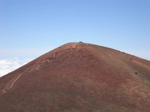
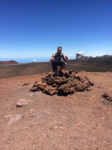
| Hike Summary: | At 13,796 feet above sea level, the peak of Mauna Kea is the highest point in the state of Hawaii. However, interestingly enough, much of its massif is below sea level. In fact, when measured from the ocean floor, its height is approximately 33,100 feet, which is more than twice the base-to-peak height of Mount Everest, making it the tallest mountain on Earth. Although there is a trail that leads from the visitor center at elevation 9,200 feet to the summit area, there is an easier option if you are limited in time. In essence, you can drive the partially paved and partially gravel road to the various observatories located near the summit. But, in order to actually stand atop the true summit, Pu’u Wekiu, you have to trek up the short 0.2-mile roundtrip summit trail. It’s a relatively easy hike given the distance, but I’ve rated it easy to moderate due to the altitude. |


There are no comments yet.