Estatoe - Member Hike
| Hike Name: | Estatoe |
|---|---|
| Country: | United States |
| State: | South Carolina |
| Nearby Town: | Pickens |
| Rating: |  |
| Directions: | From the intersection of Highway 11 and 178, take 178 toward Rosman, NC. You will wind up the mountain and after several miles you will come to a very sharp left turn onto a gravel/dirt road. This is also the parking area for one of trailheads for the Foothills Trail. |
| Total Hike Distance: | 5.00 miles |
| Hike Difficulty: | Moderate |
| Permit Required: | No |
| Hike Type: | In & Out, Backtrack Hike |
| Hike Starts/Ends: | Parking Lot |
| Trails Used: | Estatoe |
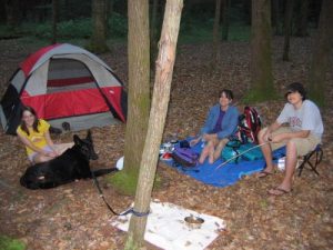
| Backcountry Campsites: | Yes |
| Backcountry Water Sources: | Streams, Rivers |
| Management: | None |
| Contact Information: | Possibly Pickens County tourism |
| Best Season: | Winter, Spring, Summer, Fall |
| Users: | Hikers |
| Road Conditions: | Maintained Gravel or Dirt Roads |
| Hike Summary: | From the parking area walk up the dirt road to you get to a gate on the left. Go around the gate and follow the trail. There is one place the trail is questioned and there is a wooden stand with map to make sure you are going the correct way. The hike is mainly down hill. So the return trip is more strenuous. There are several nice camping spots along the river. Estatoe was the cherokee word for the Carolina Parakeet. |
Recommended
Trip Reports
| Date | Rating | Duration | Hiker | |
|---|---|---|---|---|

|
February 20, 2010 |  |
3 hours | lobo41 |

|
May 6, 2009 |  |
2 days | hikingdiva |


 Trail Map For This Area
There are no comments yet.