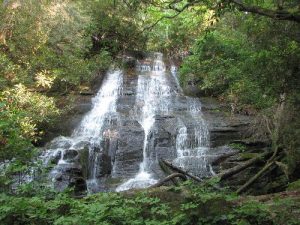
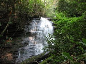
Bee Cove Falls - Member Hike
| Hike Name: | Bee Cove Falls |
|---|---|
| Country: | United States |
| State: | South Carolina |
| Nearby Town: | Mountain Rest |
| Rating: |  |
| Directions: | From Walhalla drive north on SC 28 for 8 miles to the junction of SC 28 and SC 107, and bear right (north) on to SC 107 for approx 12.5 miles. After you pass Fish Hatchery Road, look for a vehicle turn around on the left side of the road. FS 702 is about 150 yards past the turn around on the right side of SC 107. (The day I was there the FS 702 sign was hidden by underbrush.) There is room for approx 2 cars to park off the side of FS 702 or park at the turn around. |
| Total Hike Distance: | 3.00 miles |
| Hike Difficulty: | Moderate to Difficult |
| Permit Required: | No |
| Hike Type: | In & Out, Backtrack Hike |
| Hike Starts/Ends: | FS 702 and Hwy 107 |
| Trails Used: | FS 702 and Hwy 107 |
| Backcountry Campsites: | No |
| Backcountry Water Sources: | Streams |
| Management: | U.S. Forest Service |
| Contact Information: | Sumter National Forest, Andrew Pickens Ranger District, 112 Andrew Pickens Circle, Mountain Rest, SC, 29664. Telephone: 864-638-9568 |
| Best Season: | Winter, Spring, Summer, Fall |
| Users: | Hikers |
| Road Conditions: | Primary Paved Roads |
| Hike Summary: | 1. Hike down FS 702 (east) for about a mile, and just after crossing Bee Cove Creek, take the fork to the right. 2. Follow the road along Bee Cove Creek for about 0.3 miles to a three-way junction and take the road to the right over an earthen mound intended to block vehicular traffic. 3. At 0.1 mile, the road curves to the left. Take the less well-defined path on your right here. There are quite a few low-lying logs spaced across this section of the path. 4. A little less than 0.1 mile later, this path begins to disappear. Near this point, on your right, look for a white pine and large, crooked chestnut oak. You will be able to hear the falls, even though they are still beyond sight. 5. You are within 300 feet of the falls and will be able to see a faint trail to the left going down the hill. From this point on, it is a fairly steep descent. Follow the trail and the sound of the plunging water to find the first cascade. It is a bit of a scramble to get to get to the base of the first fall. 6. Descending downstream, there are allegedly four smaller falls. (I was only able to find 2 others) The descent is difficult and slow because of the rhododendron and underbrush growing alongside the creek. Proceed with caution. |
Recommended
Trip Reports
There are no Trip Reports yet.


 Trail Map For This Area
There are no comments yet.