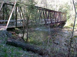
AT from Clingman's Dome to Fontana Dam - Member Hike
| Hike Name: | AT from Clingman's Dome to Fontana Dam |
|---|---|
| Country: | United States |
| State: | North Carolina |
| Nearby Town: | Cherokee, NC |
| Rating: |  |
| Directions: | 1. Head west on Towne Lake Pkwy toward Wall St 0.6 mi 2. Turn right to merge onto GA-5 25.5 mi 3. Continue straight onto GA-5/GA-515/Zell Miller Mountain Pkwy 42.2 mi 4. Turn left at GA-60 Entering North Carolina 9.4 mi 5. Continue on NC-60 5.0 mi 6. Turn right at US-64/US-74 Continue to follow US-74 30.4 mi 7. Turn left at US-129 11.5 mi 8. Turn right at NC-143/Sweetwater Rd 8.8 mi 9. Turn left at Fontana Rd/NC-28 9.9 mi 10. Turn right at NC-1245 0.1 mi 11. Turn left to stay on NC-1245 We left a vehicle here! 1. Head east on NC-1245 toward Appalachian Trail 1.3 mi 2. Turn right to stay on NC-1245 0.1 mi 3. Turn left at Fontana Rd/NC-28 Continue to follow NC-28 21.5 mi 4. Turn left at NC-19/US-74 Continue to follow US-74 15.1 mi 5. Take exit 74 for US-441 N toward Cherokee 0.5 mi 6. Merge onto US-441 4.9 mi 7. Turn right at NC-19/Tsalagi Rd/US-441 0.5 mi 8. Turn left at US-441 Entering Tennessee 19.0 mi 9. Turn left at Clingmans Dome Rd Entering North Carolina |
| Total Hike Distance: | 39.20 miles |
| Hike Difficulty: | Very Difficult |
| Permit Required: | Yes |
| Hike Type: | One-Way, Shuttle Hike |
| Hike Starts: | Clingman's Dome, NC |
| Hike Ends: | Fontana Dam, Lake Fontana |
| Trails Used: | Appalachian Trail, Eagle Creek Trail |
| Backcountry Campsites: | Yes |
| Backcountry Water Sources: | Streams, Springs |
| Management: | National Park Service |
| Contact Information: | Unknown |
| Best Season: | Spring, Fall |
| Users: | Hikers |
| Road Conditions: | Primary Paved Roads |
| Hike Summary: | This hike takes you from Clingman's Dome, the highest point on the Appalachian Trail at 6643 ft elevation. Descend down to Double Spring Gap Shelter, then an ascent back up to Siler's Bald and Shelter. From Siler's Bald, hike for 12 miles, ascending up Thunderhead Mt's 3 peaks, including Rocky Top, on to Spence Field Shelter at the junction of Eagle Creek Trail. From here, continue on the AT, or take Eagle Creek Trail, which crosses Eagle Creek some 20 times, then continues a series of ascents and descents in switchback form around Fontana Lake to the Dam. (39.2 miles) |
Recommended
Trip Reports
| Date | Rating | Duration | Hiker | |
|---|---|---|---|---|

|
April 15, 2005 |  |
2 days, 4 hours, 30 minutes | Little John |


 Trail Map For This Area
One reply on “AT from Clingman's Dome to Fontana Dam - Member Hike”
Great pics, looks damn cold.