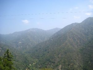
Mt. Zion - Gabielino Trail - Angeles Mts. - Member Hike
| Hike Name: | Mt. Zion - Gabielino Trail - Angeles Mts. |
|---|---|
| Country: | United States |
| State: | California |
| Nearby Town: | Arcadia |
| Rating: |  |
| Directions: | From Southern California: 405 N. to Long Beach. Take the 605 N. (Exit 24) Merge onto 210 West Take the Santa Anita Avenue. exit and drive north through the mountains about 4.5 miles until you reach Chantry Flats and the parking lot. You must obtain a National Adventure Pass (pretty much just a parking pass) from the station at Chantry Flats. |
| Total Hike Distance: | 5.60 miles |
| Hike Difficulty: | Easy to Moderate |
| Permit Required: | No |
| Hike Type: | Roundtrip, Loop Hike |
| Hike Starts/Ends: | Chantry Flats |
| Trails Used: | San Olene Fire Road to Upper Winter Creek. (Trail to the right) Upper Winter Creek to Lower Winter Creek. (Stay Right) Follow Lower Winter Creek to T and go left on the Mt. Zion Trail. Mt. Zion Trail to Mt. Zion Spur Trail (Side Trip takes you to top of mt. – dead end) Hike back down to Junction Continue on the Mt. Zion Trail Sturdevant and Gabrielino trail (stay right) Follow Gabrielino trail to Sturdevant falls and back to the parking lot. |
| Backcountry Campsites: | Yes |
| Backcountry Water Sources: | Streams, Rivers |
| Management: | State Forest Service |
| Contact Information: | Angeles National Forest Supervisor's Office 701 N. Santa Anita Ave. Arcadia, CA 91006 Jody Noiron, Forest Supervisor (626) 574-5200 FAX (626) 574-5233 CRS 1 800 735 2929 M-F 8:00 am - 4:30 pm |
| Best Season: | Spring, Fall |
| Users: | Hikers, Dogs |
| Road Conditions: | Secondary Paved Roads |
| Hike Summary: | This hike starts at Chantry Flat and heads up the fire road toward Upper Winter Creek Trail (about 0.5 miles). When you get to the trail sign, head uphill to your right (2.25 miles). At the “T”, follow the Lower Winter Creek trail to the right (1.8 miles). Soon after (approx. 0.25 miles) take the Mt. Zion Trail (2.6 miles) -- Side hike: If you want to visit the top of Mt. Zion. Follow the sign at the Junction for the Zion Spur Trail. This is a short uphill hike of about 0.15 miles. Continue following the Mt. Zion Trail until you intersect the Sturtevant/Gabrielino Trail (right/east). The Gabrielino trail takes you by Sturdevant Falls, with a short 0.25 mile side trip on Falls Trail, and back to the parking lot. |


There are no comments yet.