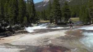
Yosemite - Lyell Canyon - Member Hike
| Hike Name: | Yosemite - Lyell Canyon |
|---|---|
| Country: | United States |
| State: | California |
| Nearby Town: | Yosemite National Park |
| Rating: |  |
| Directions: | In Yosemite, take Tioga Road/Hwy. 120 to Tuolumne Meadows. Park on the roadside near the Dog Lake/Lembert Dome trailhead. |
| Total Hike Distance: | 10.00 miles |
| Hike Difficulty: | Easy |
| Permit Required: | No |
| Hike Type: | In & Out, Backtrack Hike |
| Hike Starts/Ends: | Lyell Canyon trailhead |
| Trails Used: | John Muir Trail |
| Backcountry Campsites: | No |
| Backcountry Water Sources: | Streams, Rivers |
| Management: | None |
| Contact Information: | Unknown |
| Best Season: | |
| Users: | |
| Road Conditions: | Primary Paved Roads, Secondary Paved Roads, Maintained Gravel or Dirt Roads |
| Hike Summary: | Walk to the back of the Tuolumne Meadows campground and pick up the John Muir Trail. Follow the flat trail over seasonal creek crossings through the forest, and emerge into the wide meadows of Lyell Canyon. Follow the lazy Lyell Fork up the canyon, passing numerous, tempting swimming and sunbathing spots. The hike is flat, easy, and scenic. Wander for 4 or 5 miles (or more!), then retrace your steps to the car. If you prefer to camp along the river, you will need a wilderness permit, and you must hike at least 4 miles from the trailhead. |


There are no comments yet.