Rocktown - Member Hike
| Hike Name: | Rocktown |
|---|---|
| Country: | United States |
| State: | Georgia |
| Nearby Town: | LaFayette |
| Rating: |  |
| Directions: | 75 N to exit #320. Left onto 136 to LaFayette. From LaFayette take HWY 193 East for 2.5 miles to Chamberlain road turn Left. Go 3.3 miles to the Crockford-Pigeon Mountain WMA check station sign. Turn right into the WMA. Check station on left, go up the mountain for 4.6 miles to Rocktown Road. Gravel road .7 miles to parking area. |
| Total Hike Distance: | 2.00 miles |
| Hike Difficulty: | Easy |
| Permit Required: | No |
| Hike Type: | In & Out, Backtrack Hike |
| Hike Starts/Ends: | Rocktown Parking Area |
| Trails Used: | Rocktown Trail |
| Backcountry Campsites: | No |
| Backcountry Water Sources: | None |
| Management: | Other |
| Contact Information: | Unknown |
| Best Season: | Winter, Spring, Summer, Fall |
| Users: | Hikers, Dogs |
| Road Conditions: | Primary Paved Roads, Secondary Paved Roads, Maintained Gravel or Dirt Roads |
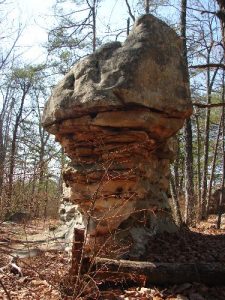
| Hike Summary: | This is a short easy hike that leads to a large boulder field. Plan to spend a few minutes hiking and hours climbing and exploring the boulders 🙂 |


There are no comments yet.