Great Smoky Mountain National Park - Charlies Bunion - Member Hike
| Hike Name: | Great Smoky Mountain National Park - Charlies Bunion |
|---|---|
| Country: | United States |
| State: | North Carolina |
| Nearby Town: | Cherokee |
| Rating: |  |
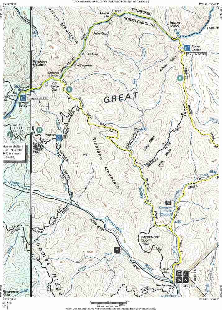
| Directions: | From Atlanta and points south follow U.S. 441 and 23 North. U.S. 441 leads directly to the Great Smoky Mountain National Park. Follow US 441 past the Oconaluftee Visitor Center, then a few additional miles where you will see signs for the Smokemont Campground. |
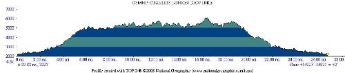
| Total Hike Distance: | 28.70 miles |
| Hike Difficulty: | Difficult |
| Permit Required: | Yes |
| Hike Type: | Roundtrip, Loop Hike |
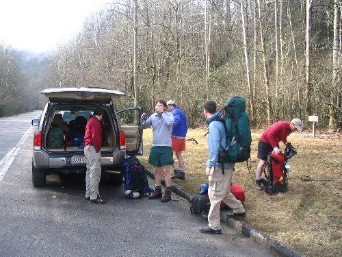
| Hike Starts/Ends: | Smokemont Campground |
| Trails Used: | Appalachian Trail, Bradley Fork, Chasteen Creek, Dry Sluice Gap, Hughes Ridge Trails |
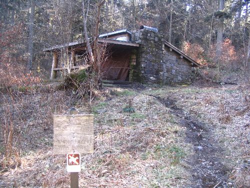
| Backcountry Campsites: | Yes |
| Backcountry Water Sources: | Streams, Springs |
| Management: | National Park Service |
| Contact Information: | Great Smoky Mountains National Park 107 Park Headquarters Road Gatlinburg, TN 37738 (865) 436-1200 |
| Best Season: | Spring, Summer, Fall |
| Users: | Hikers |
| Road Conditions: | Primary Paved Roads, Secondary Paved Roads |
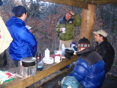
| Hike Summary: | This hike in the Great Smoky National Park takes the long route to Charlie's Bunion via Smokemont Campground. It starts with a long nearly 4000' climb to the ridge line at the Appalachian Trail, heads west toward Charlie's Bunion, then returns via a steep decent on the Dry Sluice Gap Trail. The hike requires an overnight at Peck's Corner and Ice Water Springs Shelter and offers a bailout option to Newfound Gap (which two of us took advantage of) if a shorter hike is desired. |
Recommended

 Trail Map For This Area
Trip Reports
| Date | Rating | Duration | Hiker | |
|---|---|---|---|---|

|
February 24, 2008 | |
2 days | BirdShooter |

|
February 22, 2008 | |
2 days | BirdShooter |
There are no comments yet.