Georgia Bartram Trail - Member Hike
| Hike Name: | Georgia Bartram Trail |
|---|---|
| Country: | United States |
| State: | Georgia |
| Nearby Town: | Clayton |
| Rating: |  |
| Directions: | Trailhead is on hwy 28 south of Warwoman Road near Clayton Georgia or |
| Total Hike Distance: | 46.00 miles |
| Hike Difficulty: | Moderate to Difficult |
| Permit Required: | No |
| Hike Type: | Roundtrip, Loop Hike |
| Hike Starts/Ends: | 3 Forks Campground on Overflow Creek Road |
| Trails Used: | Bartram Trail, Three Forks Trail, Overflow Creek rd, hwy 28 |
| Backcountry Campsites: | Yes |
| Backcountry Water Sources: | Streams, Springs |
| Management: | U.S. Forest Service |
| Contact Information: | http://georgiatrails.com/trails/bartram.html Chattahoochee National Forest |
| Best Season: | Spring, Summer, Fall |
| Users: | Hikers, Dogs |
| Road Conditions: | Maintained Gravel or Dirt Roads, Unmaintained Gravel or Dirt Roads |
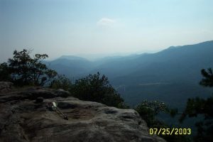
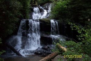
| Hike Summary: | I hiked the Georgia Bartram in July of 03. It is a very scenic and nicely maintained trail with lots of water and waterfalls. The Three Forks Trail which comes down off Rabun Bald is steep. My favorite campsite of the trip was on this side trail. I parked my car at the West Fork NFS campground on Overflow Creek Road and walked down to Warwoman Rd, then to hwy 28 and then to the trailhead on 28. So when I came down from Rabun Bald, I took Overflow Creek road back to my car. It is a pretty roadwalk down with alot of nice camp areas along side the creek. |
Recommended
Trip Reports
There are no Trip Reports yet.


There are no comments yet.