Weston Lake Loop (Congaree National Park) - Member Hike
| Hike Name: | Weston Lake Loop (Congaree National Park) |
|---|---|
| Country: | United States |
| State: | South Carolina |
| Nearby Town: | Hopkins |
| Rating: |  |
| Directions: | From Columbia, drive southeast on SC 48 (Bluff Road) for approximately 12 miles and bear right onto Old Bluff Road (Richland County S-40-734). Follow the signs to the Congaree National Park. |
| Total Hike Distance: | 4.40 miles |
| Hike Difficulty: | Easy |
| Permit Required: | Yes |
| Hike Type: | Roundtrip, Loop Hike |
| Hike Starts/Ends: | Board Walk |
| Trails Used: | Board Walk Trail, Yellow Blazed Weston Lake Loop |
| Backcountry Campsites: | Yes |
| Backcountry Water Sources: | Streams, Lakes, Springs |
| Management: | National Park Service |
| Contact Information: | 8:30 a.m. to 5 p.m. (Vehicles must be parked outside the gate in the after hours parking lot by 5 p.m.) Congaree National Park , 100 National Park Road, Hopkins, SC, 29061, 803-776-4396. (Visitor Center open: 8:30 a.m. to 5 p.m.) Contact the Visitor Center for primitive camping information. |
| Best Season: | Winter, Spring, Summer, Fall |
| Users: | Hikers, Bikers, Dogs |
| Road Conditions: | Primary Paved Roads, Secondary Paved Roads |
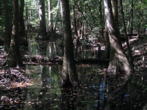
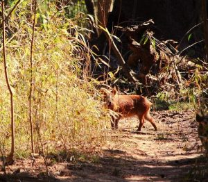
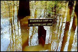
| Hike Summary: | Hiking, Camping, Canoeing, and Kayaking and trees as high as 16 stories! Sounds like a great weekender to me plus...NO FEES (probable camping fees)! From Weston Lake, at the end of the elevated boardwalk, you can extend your hike on this yellow-blazed, mostly-level, occasionally slippery, connecting loop trail. You will skirt Weston Lake, and pass along Cedar Creek, before connecting to the low boardwalk that leads back to the Visitor Center. From the trails in the 22,200 acre Congaree Swamp, you can view the last major section of old growth bottomland forest in the country. You will see towering trees - some as tall as 16-story buildings - such as ancient loblolly pines, bald cypress, water tupelo, American elm, cherrybark oak, sweetgum, and hickory. As you walk through the various flood plain forest habitats, look for pileated woodpeckers, barred owls, osprey, great blue heron, and a variety of other birds, as well as otter, deer, wild-hogs, iridescent skinks, alligators, snakes and other wildlife. Remember to wear insect repellent and protective clothing to ward off poison ivy, stinging insects, and mosquitoes. For longer trails, you may want to carry water, first-aid supplies, and a map and compass. The backwoods trails are maintained on a limited scale and may be blocked at any time by fallen trees or debris washed in during flooding. Be sure to check on trail conditions before starting your hike! Trails are foot-traffic only. Pets are permitted on leashes on designated trails but they are not allowed on boardwalks. Restrooms and picnic tables are located near the Visitor Center where you can pick up a map, learn from the natural exhibits, and ask about special events such as night tours, and the owl prowl. MAP: http://www.sctrails.net/TRAILS/MAPS/CongareeNatlParkmap.html |
Recommended
Trip Reports
| Date | Rating | Duration | Hiker | |
|---|---|---|---|---|

|
October 10, 2010 |  |
1 hour | gmyersut |

|
February 17, 2010 |  |
5 hours | SCguide1 |

|
December 27, 2009 |  |
3 hours | hikingdiva |


 Trail Map For This Area
There are no comments yet.