Mt. Scenery - Member Hike
| Hike Name: | Mt. Scenery |
|---|---|
| Country: | Netherlands Antilles |
| Region: | Saba |
| Nearby Town: | Windwardside |
| Rating: |  |
| Directions: | From Saint Maarten, take a boat ride or airplane to the small island of Saba. Latitude - 63.13 West Longitude - 17.38 North |
| Total Hike Distance: | 2.50 miles |
| Hike Difficulty: | Very Difficult |
| Permit Required: | No |
| Hike Type: | In & Out, Backtrack Hike |
| Hike Starts/Ends: | Windwardside |
| Trails Used: | Mt. Scenery |
| Backcountry Campsites: | No |
| Backcountry Water Sources: | None |
| Management: | National Park Service |
| Contact Information: | Saba Conservation Foundation P.O. Box 18 The Bottom, Saba Netherlands Antilles Telephone: ++ 599 416 3295 Fax: ++ 599 416 3435 http://www.sabapark.org/ http://www.sabatourism.com Nice photos and account of an island visit: http://www.paticat.com/cruising/saba.html |
| Best Season: | Winter, Spring, Summer, Fall |
| Users: | Hikers |
| Road Conditions: | Primary Paved Roads |
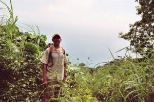
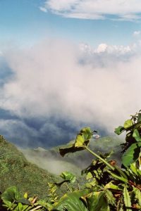
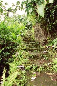
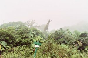
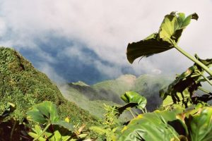
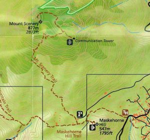
| Hike Summary: | Holy Stairmaster, Batman! The last full day of my honeymoon (11/24/06), I left the Missus at the beaches in St. Martin for the 30 mile catamaran ride to Saba to climb the tallest peak in the Dutch kingdom, Mt. Scenery. This is a very steep volcanic island that is only 5 square miles in area, but rises to a height of 2877 feet. (877 m). I arrived at Port Bay and negotiated a $25 fee with a local taxi driver to drop me off a tthe trailhead and pick me up at the trailhead at 3. Probably some of the best spent $25 I've ever had to spend. The island has many trails that criss cross it, but the mountain trail begins about 100 feet before you reach the edge of Windwardside from Port Bay at an elevation of about 1300 ft. From here, it is about 1100 steps to the top of Mt. Scenery. The steps are not high steps, but you will be hiking through a rainforest (high humidity) so the rock steps are a bit slick (and downright trecherous coming down). I am told that the giftshop has hiking sticks, but I didn't use one. I slipped a couple of times on the way down, but never truly busted by ass. I did not see anyone on the mountian during my 3.5 hour roundtrip. Near the top, you will probably be climbing through clouds, so visibility is sparse. When you get a view, boy is it worth it! If you start early in the day, I was told that there tends to be less clouds. At the top, it is quite muddy and the mud sticks to you like glue. There is also a rop at the very top to help you climb the last few 30 vertical feet or so. Sure was nice to walk into Windwardside before the taxi picked me up at 3 to see the sights and grab a beer! |


2 replies on “Mt. Scenery - Member Hike”
this mountain is awsome ……….. i climb it already
You must be a world traveler. Looks beautiful.