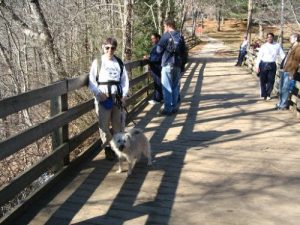
Amicalola Falls State Park - East Ridge Trail - Member Hike
| Hike Name: | Amicalola Falls State Park - East Ridge Trail |
|---|---|
| Country: | United States |
| State: | Georgia |
| Nearby Town: | Dawsonville, Georgia |
| Rating: |  |
| Directions: | Take Ga. 400 to Ga. 53 towards Dawsonville. Turn right on Elliott Family Parkway (Hwy 183), and continue on Hwy 183 until it ends at GA-52. Turn right on GA-52, the entrance to the park is on the left about 1 mile past Burt's Pumpkin Farm on the left. |
| Total Hike Distance: | 2.00 miles |
| Hike Difficulty: | Moderate to Difficult |
| Permit Required: | Yes |
| Hike Type: | In & Out, Backtrack Hike |
| Hike Starts/Ends: | Visitors Center |
| Trails Used: | East Ridge |
| Backcountry Campsites: | No |
| Backcountry Water Sources: | None |
| Management: | State Park Service |
| Contact Information: | Amicalola Falls State Park, 418 Amicalola Falls Lodge Road, Dawsonville, Georgia, 30534 Phone: (706)265-8888 Website = http://www.gastateparks.org/info/amicalola/ |
| Best Season: | Winter, Spring, Summer, Fall |
| Users: | Hikers |
| Road Conditions: | Primary Paved Roads |
| Hike Summary: | Not a long hike but very steep with neat views along the way. The falls are impressive but you get a better appreciation from below. But the view at the top of the falls is wonderfull. If you want to appreciate the top of the falls without hiking up, you CAN drive up - but the hike is so much more rewarding. The East Ridge Trail at Amicalola Falls State Park is actually the first mile of a much longer trail, the Southern Terminus Access Trail to Springer Mountain. This blue-blazed trail provides access to the start of the Appalachian Trail. East Ridge Trail climbs to the top of Amicalola Falls, rising an average of 80 feet for each 500 feet of trail. It is one of a handful of trails considered strenuous simply because of the climb. To hike this trail park in the lot across the street from the visitor center. Cross the street towards the brown single-level stone and wood visitors center and walk around it to the right or walk through the center itself. Inside are some natural history displays that are enjoyable and the gift shop sells books of regional interest and Amicalola Falls t-shirts. Behind the building the trail entrance is marked by a field stone and cement arch, followed by a Maine to Georgia Appalachian Trail sign, a stone in the shape of Georgia. The path climbs a set of steps, then begins a switchback journey up the steep-sided valley walls of the Amicalola River watershed. The river follows a southerly route, eventually joining the Etowah before creating Lake Allatoona. About halfway up the mountain the pathway curves deep into a steep-sided mountain cove, where it crosses a gully on a wooden bridge. In this area an extremely mature second-growth forest is begining to take on the appearance of an old-growth forest, a success story for Georgia's state park system. As the path exits the cove it once again begins its steep, switched ascent to the top of the East Ridge, finally coming out on a gravel road. Turn left and continue climbing. Quickly the path, which has been in full shade, comes into the open sunlight. The steep slope of the ridge is replaced by a rock wall and the gravel/rock road begins a sharp ascent to the falls. In this area the view to the left is simply stunning and worth the hike. Georgia's piedmont, occasionally broken by the foothills of the Southern Blue Ridge Mountains, spreads out to the south and west. Approaching the falls, there is a gate, along with a well-placed rock intended to prevent cars from driving down the hiking trail. Just past the gate on the left is a bathroom with snack vending machines. Continue past this to a set of railed cement steps that take you to the wooden overlook that affords a spectacular view of Amicalola Falls and the river's watershed. Above the falls is an area of interlocking trails, including the Wetlands Trail and a fitness trail that provides access to the falls for folks spending the night at Amicalola Lodge. |
Recommended
Trip Reports
There are no Trip Reports yet.


There are no comments yet.