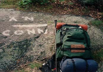
Appalachian Trail - Conneticut - Member Hike
| Hike Name: | Appalachian Trail - Conneticut |
|---|---|
| Country: | United States |
| State: | Connecticut |
| Nearby Town: | Kent |
| Rating: |  |
| Directions: | MA/CT Border: The MA/CT State Line on the Appalachian Trail is one mile south of Jug End Road in South Egremont, MA. CT/NY Border: The CT/NY State Line on the Appalachain Trail is at Hoyt Road, 0.25 miles south of Conn/NY 55, which is just West of the CT/NY border. |
| Total Hike Distance: | 51.60 miles |
| Hike Difficulty: | Moderate to Difficult |
| Permit Required: | No |
| Hike Type: | One-Way, Shuttle Hike |
| Hike Starts: | New York/Conneticut Border |
| Hike Ends: | Conneticut/Massachusetts Border |
| Trails Used: | Appalachian Trail |
| Backcountry Campsites: | Yes |
| Backcountry Water Sources: | Streams, Rivers, Lakes, Springs |
| Management: | Other |
| Contact Information: | Appalachian Trail Conference P.O. Box 807 799 Washington Street Harpers Ferry, WV 25425-0807 Phone: (304) 535-6331 Fax: (304) 535-2667 http://www.appalachiantrail.org |
| Best Season: | Spring, Summer, Fall |
| Users: | Hikers, Dogs |
| Road Conditions: | Primary Paved Roads, Secondary Paved Roads, Maintained Gravel or Dirt Roads |
| Hike Summary: | There are about fifty miles of the Appalachian Trail in the State of Connecticut and the elevations are fairly moderate and range from 260 to 2,316 feet. The route heading northbound starts near the Ten Mile River and crosses the 120 foot Ned Anderson Memorial Bridge. It then passes near the towns of Kent, Cornwall Bridge, and Salisbury before ascending 2,000 foot Bear Mountain and dropping into Sages Ravine near the CT/MA border. |


There are no comments yet.