White River National Forest - Buckskin Pass - Member Hike
| Hike Name: | White River National Forest - Buckskin Pass |
|---|---|
| Country: | United States |
| State: | Colorado |
| Nearby Town: | Aspen |
| Rating: |  |
| Directions: | Maroon Lake - Drive 1/2 of a mile west of Aspen on Highway 82 and turn left at the light onto Maroon Creek Road. Drive 9 1/2 miles on Maroon Creek Road to the Day Use parking area at Maroon Lake. From mid-June through September, the Maroon Creek Road beyond the T-Lazy Seven Ranch is closed from 8:30am-5pm. You will need to take a shuttle. Ask the Forest Service for a bus schedule. Snowmass Creek- We caught a hitch from this trailhead (although there is very little traffic on this road and we were lucky.) I do not know directions to this trailhead. |
| Total Hike Distance: | 15.80 miles |
| Hike Difficulty: | Difficult |
| Permit Required: | No |
| Hike Type: | One-Way, Shuttle Hike |
| Hike Starts: | Maroon Lake |
| Hike Ends: | Snowmass Creek |
| Trails Used: | Maroon-Snowmass Trail |
| Backcountry Campsites: | Yes |
| Backcountry Water Sources: | Streams, Rivers, Lakes |
| Management: | U.S. Forest Service |
| Contact Information: | White River National Forest Aspen Ranger District 806 W. Hallam Aspen, Colorado 81611 970-925-5277 |
| Best Season: | Summer |
| Users: | Hikers, Dogs |
| Road Conditions: | Primary Paved Roads, Secondary Paved Roads, Maintained Gravel or Dirt Roads |
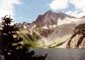
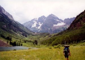
| Hike Summary: | We initially planned a 28 mile loop hike through the Maroon Bells-Snowmass Wilderness, but changed our mind due to the numerous 3000' climbs. The Ox and I ended up hiking from Maroon Lake to the Maroon-Snowmass trailhead near Snowmass Creek, a one-way shuttle hike that required a hitch at the end. Nonetheless, the views from Buckskin Pass and at Maroon and Snowmass Lakes were spectacular, and the fishing at Snowmass Lake was decent. |



There are no comments yet.