Amadahy Trail - Member Hike
| Hike Name: | Amadahy Trail |
|---|---|
| Country: | United States |
| State: | Georgia |
| Nearby Town: | Ellijay |
| Rating: |  |
| Directions: | Turn left onto Hwy 282 in East Ellijay. Follow 282 West past the ridgeway recreation entrance Pass Woodring Drive Turn Left onto Woodring Branch Road Travel ~3.2 miles to trailhead Turn right at Adamahy Trail for the parking area |
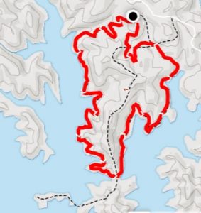
| Total Hike Distance: | 4.30 miles |
| Hike Difficulty: | Easy to Moderate |
| Permit Required: | No |
| Hike Type: | Roundtrip, Loop Hike |
| Hike Starts/Ends: | Amadahy Trailhead |
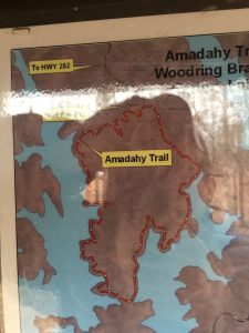
| Trails Used: | Amadahy Trail |
| Backcountry Campsites: | No |
| Backcountry Water Sources: | Lakes |
| Management: | None |
| Contact Information: | US Army Corps of Engineers Carters Lake P.O. Box 96 Oakman, GA 30732-0096 Phone: (706) 334-2248 |
| Best Season: | Winter, Spring, Fall |
| Users: | Hikers, Bikers, Dogs |
| Road Conditions: | Primary Paved Roads, Secondary Paved Roads |
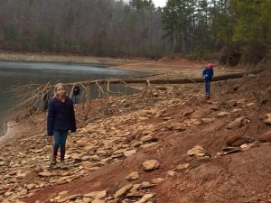
| Hike Summary: | This is a loop hike near Ellijay, GA that mostly follows the shoreline of Carter's Lake. There isn't a lot of elevation change on the trail, so it is a great hike if you are looking for a leisure walk with occasional views from the shoreline and across the water. Mountain bikers are also permitted to use this trail - so don't be surprised to see them while you are hiking. Amadahy is a Cherokee word meaning "forest water", and the lake is named after Farrish Carter who owned property in this area in the 1800's,. The US Army Corps of Engineers now manages the area, however, and the dam that creates Carter Lake is the tallest earthen dam east of Mississippi River. |
Recommended
Trip Reports
There are no Trip Reports yet.





There are no comments yet.