Wildcat Mountain - Member Hike
| Hike Name: | Wildcat Mountain |
|---|---|
| Country: | United States |
| State: | Georgia |
| Nearby Town: | Helen |
| Rating: |  |
| Directions: | From Helen, take GA 75 north for 14 miles. You will pass Andrews Cove on the right just before you reach Unicoi Gap. |
| Total Hike Distance: | 1.80 miles |
| Hike Difficulty: | Moderate |
| Permit Required: | No |
| Hike Type: | In & Out, Backtrack Hike |
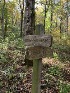
| Hike Starts/Ends: | Hogpen Gap |
| Trails Used: | Appalachian Trail, Whitley Gap Shelter Trail |
| Backcountry Campsites: | Yes |
| Backcountry Water Sources: | Springs |
| Management: | U.S. Forest Service |
| Contact Information: | Chattahoochee National Forest 508 Oak Street NW Gainesville, GA 30501 (404) 536-0541 |
| Best Season: | Spring, Summer, Fall |
| Users: | Hikers, Dogs |
| Road Conditions: | Primary Paved Roads, Secondary Paved Roads |
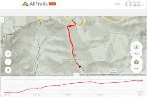
| Hike Summary: | This is a short day-hike to Wildcat Mountain that ends at a ridgeline with 180 degree views across the valley and to Cowrock Mountain. It starts at the Hogpen Gap parking area and follows the Appalachian Trail southbound climbing 200' in the first 0.3 miles until you reach a junction to the blue-blazed Whitley Gap Shelter trail. Turn left onto this trail and continue a gradual climb to Wildcat Mountain at 3698 feet and an outstanding view just past it at 0.9 miles. If you are looking for an overnight option in this area, you can continue along the ridgeline and descend another 0.6 miles to reach Whitley Gap Shelter where there is a spring and flat area in front of the structure for tent camping. From Hogpen Gap, it is 0.9 miles one-way to reach the Wildcat Mountain viewpoint or 1.5 miles to reach the shelter. |
Recommended
Trip Reports
There are no Trip Reports yet.


There are no comments yet.