Ellis Dam Trestle - Member Hike
| Hike Name: | Ellis Dam Trestle |
|---|---|
| Country: | United States |
| State: | Ohio |
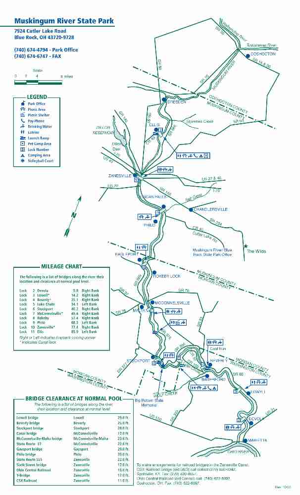
| Nearby Town: | Dresden |
| Rating: |  |
| Directions: | From Zanesville follow N. River Road/Friendly Hills Road to Ellis Dam Road. Turn right onto Ellis Dam Road which will take you directly to the trailhead for a bike path on the right. This is immediately after you cross the railroad tracks (and before you reach the official parking area and campground at the dam). |
| Total Hike Distance: | 1.00 miles |
| Hike Difficulty: | Easy |
| Permit Required: | No |
| Hike Type: | In & Out, Backtrack Hike |
| Hike Starts/Ends: | Ellis Dam Road |
| Trails Used: | Muskingum River State Parkway Bike/Hike Trail |
| Backcountry Campsites: | No |
| Backcountry Water Sources: | Rivers |
| Management: | State Park Service |
| Contact Information: | CONTACT: Dillon State Park 5265 Dillon Hills Dr., Nashport, OH 43830 PHONE: 740-453-4377 866-644-6727 for camping reservations |
| Best Season: | Spring, Summer, Fall |
| Users: | Hikers, Bikers, Dogs |
| Road Conditions: | Primary Paved Roads, Secondary Paved Roads |
| Hike Summary: | The Muskingum River Parkway and its 160-year-old navigation system were designated a National Historic Civil Engineering Landmark by the American Society of Civil Engineers in July 2001. Along with such majestic institutions as Hoover Dam, The Empire State Building and the Golden Gate Bridge, the Muskingum River's 10 hand-operated locks are now recognized as one of America's great engineering accomplishments. In its day, the system of locks and dams that extends 112 miles through southeastern Ohio, helped open the state and the entire Midwest to trade and development. Today, it serves the needs of more than 7,000 recreational boaters each year who come to fish, picnic and play in the scenic Muskingum Valley. The area has been placed on the National Register of Historic Places and will be recognized as the Muskingum River Navigation Historic District. This hike starts at the bike trail which is located on Ellis Dam Road about 0.3 miles before you reach the campground and parking area. There is a small pullout suitable for one or two cars where there is a sign that marks the trail. It is about a half mile from Ellis Dam Road to the railroad trestle and back along a paved path that is designed for bikers but also usable by hikers. There are excellent views of the Muskingum River from the trestle. |


There are no comments yet.