White River National Forest - Vail Backcountry - Member Hike
| Hike Name: | White River National Forest - Vail Backcountry |
|---|---|
| Country: | United States |
| State: | Colorado |
| Nearby Town: | Vail |
| Rating: |  |
| Directions: | From Denver take I-70 West toward Idaho Springs/Grand Junction. Take exit number 176 toward Vail, Colorado. Enter the next roundabout and take the fourth exit onto Vail Road then enter the next roundabout and take the first exit onto South Frontage Road West. Turn left onto West Lionshead Circle. Turn Left onto Lionshead Place. Follow Lionshead Place to gondola. |
| Total Hike Distance: | 6.00 miles |
| Hike Difficulty: | Moderate |
| Permit Required: | No |
| Hike Type: | In & Out, Backtrack Hike |
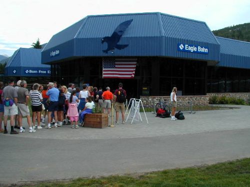
| Hike Starts/Ends: | Lionshead Gondola |
| Trails Used: | Ridge Route, Ptarmigan Loop, Cougar Ridge |
| Backcountry Campsites: | Yes |
| Backcountry Water Sources: | None |
| Management: | State Forest Service |
| Contact Information: | USDA Forest Service White River National Forest 900 Grand Ave. P.O. Box 948 Glenwood Springs CO 81602 970-945-2521 |
| Best Season: | Summer, Fall |
| Users: | Hikers, Bikers, Dogs |
| Road Conditions: | Primary Paved Roads, Secondary Paved Roads |
| Hike Summary: | We decided to do an overnight backpacking trip near the Vail ski resort to explore the White River National Forest in Summit County. Vail has a a gondola that is open in the summer months and it's much easier to access the higher elevations by catching a ride. We rode the gondola, then hiked a few miles into the Vail backcountry to set-up camp at 10,700 feet. The views from a large meadow near an exposed ridge were outstanding, especially at sunset. |


One reply on “White River National Forest - Vail Backcountry - Member Hike”
Do you need a permit for this hike? The wildflowers look beautiful.