Vickery Creek (via South Atlanta Street) - Member Hike
| Hike Name: | Vickery Creek (via South Atlanta Street) |
|---|---|
| Country: | United States |
| State: | Georgia |
| Nearby Town: | Roswell |
| Rating: |  |
| Directions: | From GA 400 North: Take exit 6, Northridge Road. Turn Right onto Northridge and go to the Roswell Road intersection. Turn Right; travel 2 miles to the intersection of Roswell Road and Riverside Road. Continue straight, and climb a hill for about 100 yards. Turn Right in to the parking area for the Allenbrook Historic Mill House. |
| Total Hike Distance: | 1.70 miles |
| Hike Difficulty: | Moderate |
| Permit Required: | No |
| Hike Type: | Roundtrip, Loop Hike |
| Hike Starts/Ends: | Allenbrook Historic Mill House |
| Trails Used: | Allenbrook Historic Mill House Trail |
| Backcountry Campsites: | No |
| Backcountry Water Sources: | Rivers |
| Management: | National Park Service |
| Contact Information: | Chattahoochee National Recreation Area 1978 Island Ford Parkway Atlanta, GA 30350 By Phone: Island Ford Visitor Contact Station 678-538-1200 Park Dispatch 770-952-0370 Emergency Number 678-538-1273 Non-emergency Number |
| Best Season: | Winter, Spring, Fall |
| Users: | Hikers, Dogs |
| Road Conditions: | Primary Paved Roads |
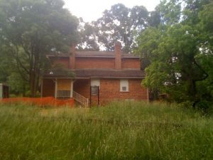
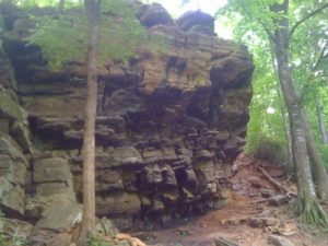
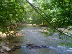
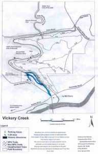
| Hike Summary: | This short hike starts at the parking area for the Allenbrook Historic Mill House off South Atlanta Street in Roswell, GA. The Allenbrook house was built around 1857 and served as the residence and office for the manager of Ivy Woolen Mill. He hoisted a French flag in an effort to save the mills and his home during the Civil War. Union troops destroyed the mills, but left the house. To start this hike, leave the parking area and descend down past the Allenbrook house. A series of steps take you down to a steep cliff where you can descend along the large rock outcropping or you can hang a right and follow an old road down to a series of steps that drop to Vickery Creek. Either way this trail makes a loop with an extension out to the junction of Riverside Road and South Atlanta Street and the stop light an this intersection. The route along the river is pleasant with views out on to the large stream and steep cliffs and caves over a 0.3 mile stretch. |
Recommended
Trip Reports
There are no Trip Reports yet.



There are no comments yet.