Chattooga River Trail (Sect I & II) - Member Hike
| Hike Name: | Chattooga River Trail (Sect I & II) |
|---|---|
| Country: | United States |
| State: | Georgia |
| Nearby Town: | Clayton |
| Rating: |  |
| Directions: | From Clayton, GA, Take Hwy 76 to the GA/SC line. Cross the bridge and park. You will need to hike back across the bridge via the sidewalk back to the GA side to start the trail. |
| Total Hike Distance: | 20.20 miles |
| Hike Difficulty: | Moderate |
| Permit Required: | No |
| Hike Type: | One-Way, Shuttle Hike |
| Hike Starts: | Hwy 76 at the state line |
| Hike Ends: | Hwy 28 at Russell Bridge |
| Trails Used: | Chattooga River trail |
| Backcountry Campsites: | No |
| Backcountry Water Sources: | Streams, Rivers |
| Management: | U.S. Forest Service |
| Contact Information: | Sumter National Forest Andrew Pickens Ranger District 112 Andrew Pickens Circle Mountain Rest, SC 29664 Phone: (864) 638-9568 |
| Best Season: | Fall |
| Users: | Hikers, Bikers, Dogs, Horses, ATVs |
| Road Conditions: | Primary Paved Roads, Maintained Gravel or Dirt Roads |
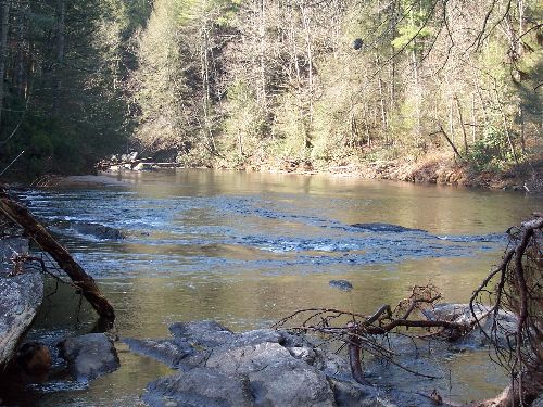
| Hike Summary: | From 76, the hike follows the river for about a mile back and forth. There are a few campsites within the first half mile but are mainly used by car campers and are generally messy. The hills are fairly steep and there arent many flat campsites unless you are close to the river. The water supply is plentiful even when you arent close to the river. The view of the river once you are following it is magnificent. At Sandy ford, there several flat campsites but are again used by car campers and frequently by kayakers. Dicks creek falls is beautiful. The trail gets a little harder after dicks creek area. The trail leaves the river and requires multiple ascents and descents until you get to Warwoman creek/ford and Earls ford road. Once again, multiple flat campsites on the south side of the creek but highly used by car campers and generally very messy. The remainder of the hike is moderate in difficulty until you reach the Long Bottom Ford area then it levels out. There is alot of flat area to pitch a tent in here. The trail takes you through an old farmstead with the remains of some old machinery. The trial crosses the west fork then shortly comes up to Hwy 28. There is a decent parking area here. |


Recommended


Trip Reports
There are no Trip Reports yet.
There are no comments yet.