Appalachian Trail - Smarts Mountain - Member Hike
| Hike Name: | Appalachian Trail - Smarts Mountain |
|---|---|
| Country: | United States |
| State: | New Hampshire |
| Nearby Town: | Wentworth |
| Rating: |  |
| Directions: | From Plymouth, NH 1. Start out going NORTHWEST on HIGHLAND ST toward SUMMER ST. 2.0 mi 2. Turn LEFT onto TENNEY MOUNTAIN HWY/RT-25 W/RT-3A S. 2.0 mi 3. Enter next roundabout and take 1st exit onto RT-25 W/MT MOOSILAUKE HWY. 11.5 mi 4. Turn LEFT onto ELLSWORTH HILL RD. If you reach STANYAN HILL RD you've gone a little too far 0.06 mi 5. Take the 1st RIGHT onto POND BRANCH RD. If you reach NICHOLS HILL RD you've gone about 2.7 miles too far 0.1 mi 6. Welcome to WENTWORTH, NH. If you reach the end of POND BRANCH RD you've gone about 0.2 miles too far 7. In WENTWORTH, NH turn left on to NH 25A, drive about 10-15 minutes until you see sign for the Appalachian Trail |
| Total Hike Distance: | 14.50 miles |
| Hike Difficulty: | Difficult |
| Permit Required: | No |
| Hike Type: | One-Way, Shuttle Hike |
| Hike Starts: | Lyme/Dorchester Road |
| Hike Ends: | NH 25A |
| Trails Used: | Appalachian Trail, Hexacube Shelter Side Trail |
| Backcountry Campsites: | Yes |
| Backcountry Water Sources: | Streams |
| Management: | U.S. Forest Service |
| Contact Information: | Dartmouth Outing Club (maintains this section of the A.T.) Phone: (603) 646-2429 (Monday through Friday, 12 noon to 4 pm, or leave a message) Cabins: (603) 646-2834 (weekdays, 9 am to noon and 1:30 to 3:30 pm) Email: thedoc@dartmouth.edu Mail: PO Box 9, Hanover, NH 03755 Fax: (603) 646-1444 Campus: 113 Robinson Hall HB: HB 6142 Website: www.dartmouth.edu/~doc |
| Best Season: | Spring, Summer, Fall |
| Users: | Hikers, Dogs |
| Road Conditions: | Primary Paved Roads, Secondary Paved Roads |
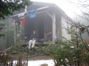
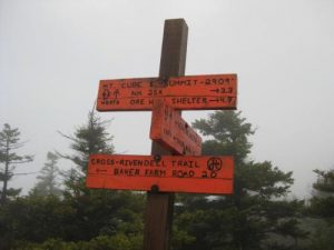
| Hike Summary: | Smarts Mountain at 2,190 feet is one of twelve mountains in New Hampshire that exceeds two thousand feet. It is located on the Appalachian Trail and has a firetower and an enclosed shelter on the summit (which is the former ranger's cabin). A series of tent platforms is located nearby and it can also be assessed from a number of blue-blazed side trails. This includes the Smarts Mountain Ranger Trail (to the southwest), the Clark Pond Loop Trail (to the south) and the Daniel Doan Trail which follows Mousley Creek (to the north and down to NH 25A). On this route, we hiked a 14 mile section headed northbound on the A.T. There are scenic views from Lamberts Ridge to Smarts Mountain and of the valley floor to the east. The summit of Mount Cube, at 2,909 feet, and rock outcroppings at Holts Ledge also offer potentially impressive views if the weather cooperates during your hike. Unfortunately, we spent most of our time in clouds with swirling mists of rain - which is not uncommon for this area. The Hexacube Shelter lies just south of the Hexacube Shelter on the A.T. and is a roomy and worthwhile stop if you plan to make this a multi-day trip. |


There are no comments yet.