Benton Mackaye Trail - Bryson Gap - Member Hike
| Hike Name: | Benton Mackaye Trail - Bryson Gap |
|---|---|
| Country: | United States |
| State: | Georgia |
| Nearby Town: | Suches |
| Rating: |  |
| Directions: | Take US 19/GA 60 north for 9 miles. Bear left on GA 60, where US 19 turns right. Continue another 7 miles to Suches, GA. From the intersection of GA 180 and GA 60 in Suches, continue north on GA 60 for another 14.8 miles to the GA 60 trailhead. Roadside parking is along the right side of the road, just beyond the trail crossing. Follow the forest road (816) from here for three miles to the Toccoa River suspension bridge. Road is narrow and rough toward the end. |
| Total Hike Distance: | 5.40 miles |
| Hike Difficulty: | Moderate |
| Permit Required: | No |
| Hike Type: | In & Out, Backtrack Hike |
| Hike Starts/Ends: | Toccoa River Suspension Bridge |
| Trails Used: | Benton Mackaye Trail |
| Backcountry Campsites: | Yes |
| Backcountry Water Sources: | Streams, Rivers |
| Management: | U.S. Forest Service |
| Contact Information: | Chattahoochee National Forest Toccoa Ranger District 6050 Appalachian Highway Blue Ridge, GA 30513 Phone: 706 632-3031 http://www.fs.fed.us/conf/ |
| Best Season: | Winter, Spring, Summer, Fall |
| Users: | Hikers, Dogs |
| Road Conditions: | Primary Paved Roads, Secondary Paved Roads, Maintained Gravel or Dirt Roads |
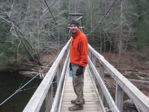
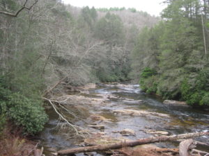
| Hike Summary: | The Benton Mackaye Trail is a work in progress, and it currently runs nearly 100 miles from the southern terminus at Springer Mountain, Georgia, to US Hwy 64 & 74 near the Ocoee River in Tennessee. The trail is named for Benton MacKaye, who first published a proposal for the creation of the Appalachian Trail in the early 1900's while hiking in Vermont. The current plan is for the Benton Mackaye Trail to continue through the Cherokee National Forest in Tennessee and eventually reach the Great Smoky Mountains National Park in North Carolina and rejoin with the Appalachian Trail. (For more information, you can visit the Benton Mackaye Trail Association website. Its members volunteer for trail development, construction, maintenance and repair.) The hike from Bryson Gap to the Toccoa River is 2.7 miles and the Benton MacKaye Trail passes through Sapling Gap at 2770' then across or near some forest service roads during the descent to the Toccoa River at 1920 feet. The is an impressive suspension bridge at the Toccoa River with a campsites on both sides of the bridge. On this hike we stopped camped at the Toccoa River and did a day hike (5.4 miles round-trip) to Bryson Gap and back. It was Thanksgiving weekend, and there were at least 40 day hikers at the suspension bridge in the hour leading up to sunset. So if you are looking for a more wilderness experience, consider camping at Bryson Gap which has a spring a few hundred yards from the trail. |
Recommended
Trip Reports
There are no Trip Reports yet.


One reply on “Benton Mackaye Trail - Bryson Gap - Member Hike”
I’ve made a day hike from highway 60 to Bryson Gap. I’ve also camped at the swinging bridge over the Toccoa River. The river is a popular destination and it’s common to find a number of people camping there on the weekend. Bryson Gap will have considerably fewer people. When I day hiked, I found no one at the gap.